Victoria geodata
Victoria (Caldas) is a seat of a second-order administrative division; located in Colombia in America/Bogota (GMT-5) time zone. With population of 4,723 people, there are 535 cities with bigger population in this country. Compared to other cities in Colombia, 54.5% of cities are located further ↑North; 52% of cities are located further →East and 60.3% of cities have higher elevation than Victoria. Note1


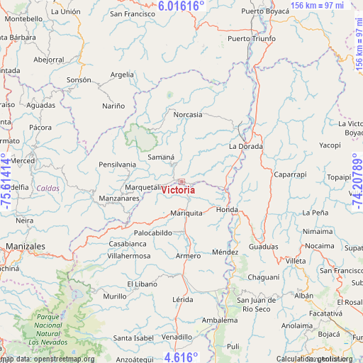
Victoria GPS coordinates[2]
5° 18' 59.328" North, 74° 54' 39.636" West
| Map corner | latitude | longitude |
|---|---|---|
| Upper-left | 6.01616°, | -75.61414° |
| Center: | 5.31648°, | -74.91101° |
| Lower-right: | 4.616°, | -74.20789° |
| Map W x H: | 155.7×155.7 km | = 96.7×96.7mi |
| max Lat: | 13.38166° ⇑54.5% North |
| Victoria: | 5.31648° |
| min Lat: | ⇓45.5% South -4.21528° |
| min Long | Victoria | max Long |
| -81.70636° | -74.91101° | -67.06996° |
| W 48%⇐ | ⇒52% E |
Elevation
Elevation of Victoria is 712 m = 2336 ft, and this is 437.3 m = 1435 ft below average elevation for this country.
| Max E: |
3342 m = 10965 ft | 60.3% |
| Avg. | 1149.3 m = 3771 ft | |
| Victoria | 712 m = 2336 ft | |
Min E: |
1 m = 3 ft | 39.7% |
See also: Colombia elevation on elevation.city.
Geographical zone
Victoria is located in North Torrid zone (between Equator and Tropic of Cancer). Distance of Equator is 591.1 km =367.3 mi to South.| Distance of | km | miles | from Victoria |
|---|---|---|---|
| North Pole | 9415.9 | 5850.8 | to North |
| Arctic Circle | 6810 | 4231.5 | to North |
| Tropic Cancer | 2014.8 | 1251.9 | to North |
| Equator | 591.1 | 367.3 | to South |


Nearby cities:
15 places around Victoria: (largest is in red/bold)
• Falan
21.9 km =13.6 mi,  191°
191°
• Fresno
22.9 km =14.2 mi,  217°
217°
• Guayabal
31.9 km =19.8 mi,  175°
175°
• Honda
22.8 km =14.2 mi,  121°
121°
• La Dorada
31.1 km =19.3 mi,  61°
61°
• Manzanares
27.8 km =17.3 mi,  255°
255°
• Marquetalia
16.1 km =10 mi, 262°
• Norcasia
28.9 km =18 mi,  4°
4°
• Padua
32.5 km =20.2 mi,  231°
231°
• Palocabildo
25.1 km =15.6 mi,  207°
207°
• Pensilvania
28.7 km =17.8 mi,  285°
285°
• Puerto Bogotá
24.1 km =15 mi, 122°
• Puerto Salgar
32.8 km =20.4 mi, 60°
• Samaná
14 km =8.7 mi,  319°
319°
• San Sebastián de Mariquita
13.2 km =8.2 mi,  171°
171°
Sources, notices
• [Note1] Compared only with cities in Colombia existing in our database
• [Src1] Map data: © OpenStreetMap contributors (CC-BY-SA)
• [Src2] Other city data from geonames.org with taken over terms of usage.
• [Src3] Geographical zone / Annual Mean Temperature by Robert A. Rohde @ Wikipedia
