Manzanares geodata
Manzanares (Caldas) is a seat of a second-order administrative division; located in Colombia in America/Bogota (GMT-5) time zone. With population of 16,278 people, there are 211 cities with bigger population in this country. Compared to other cities in Colombia, 56% of cities are located further ↑North; 58.2% of cities are located further →East and 84.3% of cities have lower elevation than Manzanares. Note1


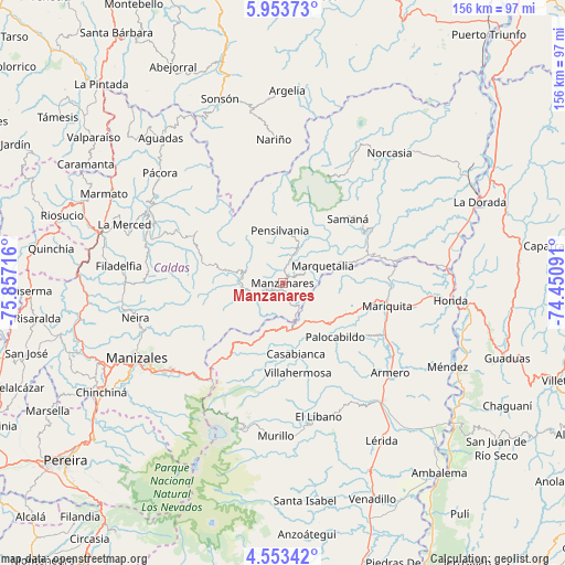
Manzanares GPS coordinates[2]
5° 15' 14.292" North, 75° 9' 14.508" West
| Map corner | latitude | longitude |
|---|---|---|
| Upper-left | 5.95373°, | -75.85716° |
| Center: | 5.25397°, | -75.15403° |
| Lower-right: | 4.55342°, | -74.45091° |
| Map W x H: | 155.7×155.7 km | = 96.7×96.7mi |
| max Lat: | 13.38166° ⇑56% North |
| Manzanares: | 5.25397° |
| min Lat: | ⇓44% South -4.21528° |
| min Long | Manzanares | max Long |
| -81.70636° | -75.15403° | -67.06996° |
| W 41.8%⇐ | ⇒58.2% E |
Elevation
Elevation of Manzanares is 2224 m = 7297 ft, and this is 1074.7 m = 3526 ft above average elevation for this country.
| Max E: |
3342 m = 10965 ft | 15.7% |
| Manzanares | 2224 m 7297 ft | |
| Avg. | 1149.3 m = 3771 ft | |
Min E: |
1 m = 3 ft | 84.3% |
See also: Colombia elevation on elevation.city.
Geographical zone
Manzanares is located in North Torrid zone (between Equator and Tropic of Cancer). Distance of Equator is 584.2 km =363 mi to South.| Distance of | km | miles | from Manzanares |
|---|---|---|---|
| North Pole | 9422.9 | 5855.1 | to North |
| Arctic Circle | 6817 | 4235.9 | to North |
| Tropic Cancer | 2021.7 | 1256.2 | to North |
| Equator | 584.2 | 363 | to South |


Nearby cities:
15 places around Manzanares: (largest is in red/bold)
• Aranzazu
37.3 km =23.2 mi,  272°
272°
• Casabianca
19.7 km =12.2 mi,  169°
169°
• Falan
26.7 km =16.6 mi,  122°
122°
• Fresno
17.2 km =10.7 mi,  130°
130°
• Frías
29.7 km =18.5 mi,  147°
147°
• Herveo
19.5 km =12.1 mi,  187°
187°
• Marquetalia
11.9 km =7.4 mi,  66°
66°
• Marulanda
12.2 km =7.6 mi,  285°
285°
• Padua
13.4 km =8.3 mi, 173°
• Palocabildo
21.5 km =13.4 mi,  135°
135°
• Pensilvania
14.4 km =8.9 mi,  356°
356°
• Samaná
25.1 km =15.6 mi,  45°
45°
• San Sebastián de Mariquita
29.6 km =18.4 mi,  101°
101°
• Victoria
27.8 km =17.3 mi,  75°
75°
• Villahermosa
25.2 km =15.7 mi, 170°
Sources, notices
• [Note1] Compared only with cities in Colombia existing in our database
• [Src1] Map data: © OpenStreetMap contributors (CC-BY-SA)
• [Src2] Other city data from geonames.org with taken over terms of usage.
• [Src3] Geographical zone / Annual Mean Temperature by Robert A. Rohde @ Wikipedia
