Saladoblanco geodata
Saladoblanco (Huila) is a seat of a second-order administrative division; located in Colombia in America/Bogota (GMT-5) time zone. With population of 1,662 people, there are 842 cities with bigger population in this country. Compared to other cities in Colombia, 90.2% of cities are located further ↑North; 80.9% of cities are located further →East and 60.8% of cities have lower elevation than Saladoblanco. Note1


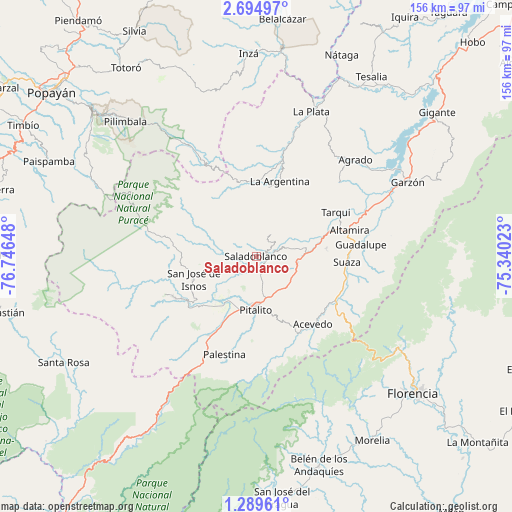
Saladoblanco GPS coordinates[2]
1° 59' 32.784" North, 76° 2' 36.06" West
| Map corner | latitude | longitude |
|---|---|---|
| Upper-left | 2.69497°, | -76.74648° |
| Center: | 1.99244°, | -76.04335° |
| Lower-right: | 1.28961°, | -75.34023° |
| Map W x H: | 156.3×156.3 km | = 97.1×97.1mi |
| max Lat: | 13.38166° ⇑90.2% North |
| Saladoblanco: | 1.99244° |
| min Lat: | ⇓9.8% South -4.21528° |
| min Long | Saladoblanco | max Long |
| -81.70636° | -76.04335° | -67.06996° |
| W 19.1%⇐ | ⇒80.9% E |
Elevation
Elevation of Saladoblanco is 1489 m = 4885 ft, and this is 339.7 m = 1115 ft above average elevation for this country.
| Max E: |
3342 m = 10965 ft | 39.2% |
| Saladoblanco | 1489 m 4885 ft | |
| Avg. | 1149.3 m = 3771 ft | |
Min E: |
1 m = 3 ft | 60.8% |
See also: Colombia elevation on elevation.city.
Geographical zone
Saladoblanco is located in North Torrid zone (between Equator and Tropic of Cancer). Distance of Equator is 221.5 km =137.6 mi to South.| Distance of | km | miles | from Saladoblanco |
|---|---|---|---|
| North Pole | 9785.5 | 6080.4 | to North |
| Arctic Circle | 7179.6 | 4461.2 | to North |
| Tropic Cancer | 2384.4 | 1481.6 | to North |
| Equator | 221.5 | 137.6 | to South |


Nearby cities:
15 places around Saladoblanco: (largest is in red/bold)
• Acevedo
26.9 km =16.7 mi,  140°
140°
• Altamira
29.5 km =18.3 mi,  74°
74°
• Elías
11.7 km =7.3 mi,  79°
79°
• Guadalupe
32.1 km =19.9 mi, 83°
• Isnos
19.9 km =12.4 mi,  249°
249°
• Isnos
22.8 km =14.2 mi, 253°
• La Argentina
23.9 km =14.9 mi,  17°
17°
• Oporapa
6.3 km =3.9 mi,  56°
56°
• Palestina
31.5 km =19.6 mi,  198°
198°
• Pital
40.4 km =25.1 mi,  41°
41°
• Pitalito
15.4 km =9.6 mi,  183°
183°
• San Agustín
27.9 km =17.3 mi,  243°
243°
• Suaza
27.7 km =17.2 mi,  93°
93°
• Tarqui
27.8 km =17.3 mi, 61°
• Timaná
12.7 km =7.9 mi,  100°
100°
Sources, notices
• [Note1] Compared only with cities in Colombia existing in our database
• [Src1] Map data: © OpenStreetMap contributors (CC-BY-SA)
• [Src2] Other city data from geonames.org with taken over terms of usage.
• [Src3] Geographical zone / Annual Mean Temperature by Robert A. Rohde @ Wikipedia
