Peque geodata
Peque (Antioquia) is a seat of a second-order administrative division; located in Colombia in America/Bogota (GMT-5) time zone. With population of 1,793 people, there are 824 cities with bigger population in this country. Compared to other cities in Colombia, 74.5% of cities are located further ↓South; 78.4% of cities are located further →East and 52.3% of cities have lower elevation than Peque. Note1


Peque GPS coordinates[2]
7° 1' 16.428" North, 75° 54' 33.336" West
| Map corner | latitude | longitude |
|---|---|---|
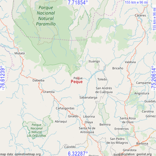
| Upper-left | 7.71854°, | -76.61239° |
| Center: | 7.02123°, | -75.90926° |
| Lower-right: | 6.32287°, | -75.20614° |
| Map W x H: | 155.2×155.2 km | = 96.4×96.4mi |
| max Lat: | 13.38166° ⇑25.5% North |
| Peque: | 7.02123° |
| min Lat: | ⇓74.5% South -4.21528° |
| min Long | Peque | max Long |
| -81.70636° | -75.90926° | -67.06996° |
| W 21.6%⇐ | ⇒78.4% E |
Elevation
Elevation of Peque is 1204 m = 3950 ft, and this is 54.7 m = 179 ft above average elevation for this country.
| Max E: |
3342 m = 10965 ft | 47.7% |
| Peque | 1204 m 3950 ft | |
| Avg. | 1149.3 m = 3771 ft | |
Min E: |
1 m = 3 ft | 52.3% |
See also: Colombia elevation on elevation.city.
Geographical zone
Peque is located in North Torrid zone (between Equator and Tropic of Cancer). Distance of Equator is 780.7 km =485.1 mi to South.| Distance of | km | miles | from Peque |
|---|---|---|---|
| North Pole | 9226.4 | 5733 | to North |
| Arctic Circle | 6620.5 | 4113.8 | to North |
| Tropic Cancer | 1825.2 | 1134.1 | to North |
| Equator | 780.7 | 485.1 | to South |


Nearby cities:
15 places around Peque: (largest is in red/bold)
• Abriaquí
46.6 km =29 mi,  201°
201°
• Briceño
40.7 km =25.3 mi,  75°
75°
• Buriticá
33.6 km =20.9 mi,  179°
179°
• Cañasgordas
32.8 km =20.4 mi, 203°
• Dabeiba
39.8 km =24.7 mi,  266°
266°
• Frontino
37.2 km =23.1 mi,  221°
221°
• Giraldo
38.2 km =23.7 mi,  187°
187°
• Ituango
23.1 km =14.4 mi,  43°
43°
• Liborina
39.7 km =24.7 mi,  164°
164°
• Olaya
45 km =28 mi,  166°
166°
• Sabanalarga
21.7 km =13.5 mi,  152°
152°
• San Andrés
28.3 km =17.6 mi,  117°
117°
• San José de la Montaña
31.4 km =19.5 mi,  127°
127°
• Toledo
23.6 km =14.7 mi,  92°
92°
• Uramita
32.2 km =20 mi,  245°
245°
Sources, notices
• [Note1] Compared only with cities in Colombia existing in our database
• [Src1] Map data: © OpenStreetMap contributors (CC-BY-SA)
• [Src2] Other city data from geonames.org with taken over terms of usage.
• [Src3] Geographical zone / Annual Mean Temperature by Robert A. Rohde @ Wikipedia
