Cañasgordas geodata
Cañasgordas (Antioquia) is a seat of a second-order administrative division; located in Colombia in America/Bogota (GMT-5) time zone. With population of 6,026 people, there are 451 cities with bigger population in this country. Compared to other cities in Colombia, 71.9% of cities are located further ↓South; 80.6% of cities are located further →East and 54.9% of cities have lower elevation than Cañasgordas. Note1


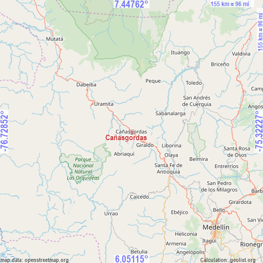
Cañasgordas GPS coordinates[2]
6° 44' 59.604" North, 76° 1' 31.404" West
| Map corner | latitude | longitude |
|---|---|---|
| Upper-left | 7.44762°, | -76.72852° |
| Center: | 6.74989°, | -76.02539° |
| Lower-right: | 6.05115°, | -75.32227° |
| Map W x H: | 155.3×155.3 km | = 96.5×96.5mi |
| max Lat: | 13.38166° ⇑28.1% North |
| Cañasgordas: | 6.74989° |
| min Lat: | ⇓71.9% South -4.21528° |
| min Long | Cañasgordas | max Long |
| -81.70636° | -76.02539° | -67.06996° |
| W 19.4%⇐ | ⇒80.6% E |
Elevation
Elevation of Cañasgordas is 1291 m = 4236 ft, and this is 141.7 m = 465 ft above average elevation for this country.
| Max E: |
3342 m = 10965 ft | 45.1% |
| Cañasgordas | 1291 m 4236 ft | |
| Avg. | 1149.3 m = 3771 ft | |
Min E: |
1 m = 3 ft | 54.9% |
See also: Colombia elevation on elevation.city.
Geographical zone
Cañasgordas is located in North Torrid zone (between Equator and Tropic of Cancer). Distance of Equator is 750.5 km =466.3 mi to South.| Distance of | km | miles | from Cañasgordas |
|---|---|---|---|
| North Pole | 9256.5 | 5751.7 | to North |
| Arctic Circle | 6650.7 | 4132.6 | to North |
| Tropic Cancer | 1855.4 | 1152.9 | to North |
| Equator | 750.5 | 466.3 | to South |


Nearby cities:
15 places around Cañasgordas: (largest is in red/bold)
• Abriaquí
13.9 km =8.6 mi,  198°
198°
• Buriticá
13.5 km =8.4 mi,  104°
104°
• Caicedo
38.6 km =24 mi,  172°
172°
• Dabeiba
38.7 km =24 mi,  315°
315°
• Frontino
12.1 km =7.5 mi,  281°
281°
• Giraldo
11.2 km =7 mi,  133°
133°
• Liborina
24.9 km =15.5 mi,  108°
108°
• Olaya
27.1 km =16.8 mi,  120°
120°
• Peque
32.8 km =20.4 mi,  23°
23°
• Sabanalarga
25.5 km =15.8 mi,  64°
64°
• San Andrés
41.5 km =25.8 mi,  65°
65°
• San José de la Montaña
39.4 km =24.5 mi, 73°
• Santa Fe de Antioquia
30.6 km =19 mi, 134°
• Sopetrán
41.6 km =25.8 mi, 131°
• Uramita
23.4 km =14.5 mi, 315°
Sources, notices
• [Note1] Compared only with cities in Colombia existing in our database
• [Src1] Map data: © OpenStreetMap contributors (CC-BY-SA)
• [Src2] Other city data from geonames.org with taken over terms of usage.
• [Src3] Geographical zone / Annual Mean Temperature by Robert A. Rohde @ Wikipedia
