San Andrés geodata
San Andrés (Antioquia) is a seat of a second-order administrative division; located in Colombia in America/Bogota (GMT-5) time zone. With population of 3,154 people, there are 668 cities with bigger population in this country. Compared to other cities in Colombia, 73.5% of cities are located further ↓South; 71.6% of cities are located further →East and 67.2% of cities have lower elevation than San Andrés. Note1


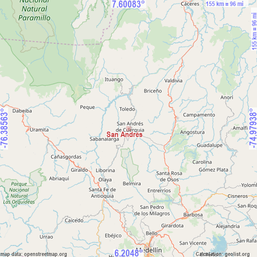
San Andrés GPS coordinates[2]
6° 54' 11.988" North, 75° 40' 57" West
| Map corner | latitude | longitude |
|---|---|---|
| Upper-left | 7.60083°, | -76.38563° |
| Center: | 6.90333°, | -75.6825° |
| Lower-right: | 6.2048°, | -74.97938° |
| Map W x H: | 155.2×155.2 km | = 96.4×96.4mi |
| max Lat: | 13.38166° ⇑26.5% North |
| San Andrés: | 6.90333° |
| min Lat: | ⇓73.5% South -4.21528° |
| min Long | San Andrés | max Long |
| -81.70636° | -75.6825° | -67.06996° |
| W 28.4%⇐ | ⇒71.6% E |
Elevation
Elevation of San Andrés is 1651 m = 5417 ft, and this is 501.7 m = 1646 ft above average elevation for this country.
| Max E: |
3342 m = 10965 ft | 32.8% |
| San Andrés | 1651 m 5417 ft | |
| Avg. | 1149.3 m = 3771 ft | |
Min E: |
1 m = 3 ft | 67.2% |
See also: Colombia elevation on elevation.city.
Geographical zone
San Andrés is located in North Torrid zone (between Equator and Tropic of Cancer). Distance of Equator is 767.6 km =477 mi to South.| Distance of | km | miles | from San Andrés |
|---|---|---|---|
| North Pole | 9239.5 | 5741.2 | to North |
| Arctic Circle | 6633.6 | 4121.9 | to North |
| Tropic Cancer | 1838.3 | 1142.3 | to North |
| Equator | 767.6 | 477 | to South |


Nearby cities:
15 places around San Andrés: (largest is in red/bold)
• Angostura
38.4 km =23.9 mi,  93°
93°
• Belmira
33.2 km =20.6 mi,  176°
176°
• Briceño
27.2 km =16.9 mi,  32°
32°
• Buriticá
32.2 km =20 mi,  230°
230°
• Giraldo
38.8 km =24.1 mi, 230°
• Ituango
31.1 km =19.3 mi,  343°
343°
• Liborina
28.9 km =18 mi,  209°
209°
• Olaya
33.8 km =21 mi, 205°
• Peque
28.3 km =17.6 mi,  297°
297°
• Sabanalarga
16 km =9.9 mi,  247°
247°
• San José de la Montaña
5.9 km =3.7 mi, 180°
• Santa Rosa de Osos
37.6 km =23.4 mi,  139°
139°
• Toledo
12.3 km =7.6 mi,  353°
353°
• Valdivia
39.5 km =24.5 mi,  42°
42°
• Yarumal
30 km =18.6 mi,  77°
77°
Sources, notices
• [Note1] Compared only with cities in Colombia existing in our database
• [Src1] Map data: © OpenStreetMap contributors (CC-BY-SA)
• [Src2] Other city data from geonames.org with taken over terms of usage.
• [Src3] Geographical zone / Annual Mean Temperature by Robert A. Rohde @ Wikipedia
