Giraldo geodata
Giraldo (Antioquia) is a seat of a second-order administrative division; located in Colombia in America/Bogota (GMT-5) time zone. With population of 1,464 people, there are 872 cities with bigger population in this country. Compared to other cities in Colombia, 71.3% of cities are located further ↓South; 79% of cities are located further →East and 74.2% of cities have lower elevation than Giraldo. Note1


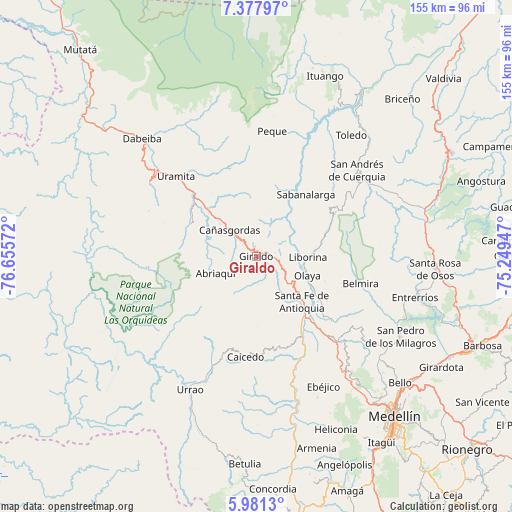
Giraldo GPS coordinates[2]
6° 40' 48.468" North, 75° 57' 9.324" West
| Map corner | latitude | longitude |
|---|---|---|
| Upper-left | 7.37797°, | -76.65572° |
| Center: | 6.68013°, | -75.95259° |
| Lower-right: | 5.9813°, | -75.24947° |
| Map W x H: | 155.3×155.3 km | = 96.5×96.5mi |
| max Lat: | 13.38166° ⇑28.7% North |
| Giraldo: | 6.68013° |
| min Lat: | ⇓71.3% South -4.21528° |
| min Long | Giraldo | max Long |
| -81.70636° | -75.95259° | -67.06996° |
| W 21%⇐ | ⇒79% E |
Elevation
Elevation of Giraldo is 1817 m = 5961 ft, and this is 667.7 m = 2191 ft above average elevation for this country.
| Max E: |
3342 m = 10965 ft | 25.8% |
| Giraldo | 1817 m 5961 ft | |
| Avg. | 1149.3 m = 3771 ft | |
Min E: |
1 m = 3 ft | 74.2% |
See also: Colombia elevation on elevation.city.
Geographical zone
Giraldo is located in North Torrid zone (between Equator and Tropic of Cancer). Distance of Equator is 742.8 km =461.6 mi to South.| Distance of | km | miles | from Giraldo |
|---|---|---|---|
| North Pole | 9264.3 | 5756.6 | to North |
| Arctic Circle | 6658.4 | 4137.3 | to North |
| Tropic Cancer | 1863.2 | 1157.7 | to North |
| Equator | 742.8 | 461.6 | to South |


Nearby cities:
15 places around Giraldo: (largest is in red/bold)
• Abriaquí
13.5 km =8.4 mi,  246°
246°
• Belmira
32.7 km =20.3 mi,  104°
104°
• Buriticá
6.6 km =4.1 mi,  49°
49°
• Caicedo
30.8 km =19.1 mi,  186°
186°
• Cañasgordas
11.2 km =7 mi,  313°
313°
• Frontino
22.4 km =13.9 mi,  296°
296°
• Liborina
15.5 km =9.6 mi,  90°
90°
• Olaya
16.5 km =10.3 mi,  110°
110°
• Peque
38.2 km =23.7 mi,  7°
7°
• Sabanalarga
24 km =14.9 mi,  38°
38°
• San Jerónimo
36.2 km =22.5 mi,  136°
136°
• San José de la Montaña
35.2 km =21.9 mi,  57°
57°
• Santa Fe de Antioquia
19.4 km =12.1 mi,  134°
134°
• Sopetrán
30.5 km =19 mi, 130°
• Uramita
34.5 km =21.4 mi, 314°
Sources, notices
• [Note1] Compared only with cities in Colombia existing in our database
• [Src1] Map data: © OpenStreetMap contributors (CC-BY-SA)
• [Src2] Other city data from geonames.org with taken over terms of usage.
• [Src3] Geographical zone / Annual Mean Temperature by Robert A. Rohde @ Wikipedia
