Nátaga geodata
Nátaga (Huila) is a seat of a second-order administrative division; located in Colombia in America/Bogota (GMT-5) time zone. With population of 2,232 people, there are 772 cities with bigger population in this country. Compared to other cities in Colombia, 86.7% of cities are located further ↑North; 75.9% of cities are located further →East and 60.5% of cities have lower elevation than Nátaga. Note1


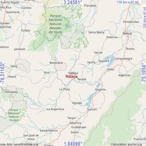
Nátaga GPS coordinates[2]
2° 32' 36.924" North, 75° 48' 30.672" West
| Map corner | latitude | longitude |
|---|---|---|
| Upper-left | 3.24581°, | -76.51165° |
| Center: | 2.54359°, | -75.80852° |
| Lower-right: | 1.84098°, | -75.1054° |
| Map W x H: | 156.2×156.2 km | = 97.1×97.1mi |
| max Lat: | 13.38166° ⇑86.7% North |
| Nátaga: | 2.54359° |
| min Lat: | ⇓13.3% South -4.21528° |
| min Long | Nátaga | max Long |
| -81.70636° | -75.80852° | -67.06996° |
| W 24.1%⇐ | ⇒75.9% E |
Elevation
Elevation of Nátaga is 1472 m = 4829 ft, and this is 322.7 m = 1059 ft above average elevation for this country.
| Max E: |
3342 m = 10965 ft | 39.5% |
| Nátaga | 1472 m 4829 ft | |
| Avg. | 1149.3 m = 3771 ft | |
Min E: |
1 m = 3 ft | 60.5% |
See also: Colombia elevation on elevation.city.
Geographical zone
Nátaga is located in North Torrid zone (between Equator and Tropic of Cancer). Distance of Equator is 282.8 km =175.7 mi to South.| Distance of | km | miles | from Nátaga |
|---|---|---|---|
| North Pole | 9724.2 | 6042.3 | to North |
| Arctic Circle | 7118.4 | 4423.2 | to North |
| Tropic Cancer | 2323.1 | 1443.5 | to North |
| Equator | 282.8 | 175.7 | to South |


Nearby cities:
15 places around Nátaga: (largest is in red/bold)
• Agrado
32.1 km =19.9 mi,  172°
172°
• Belalcázar
21.5 km =13.4 mi,  302°
302°
• Garzón
43.6 km =27.1 mi,  152°
152°
• Gigante
33.8 km =21 mi,  121°
121°
• Hobo
40.1 km =24.9 mi,  83°
83°
• Inzá
28.8 km =17.9 mi,  272°
272°
• La Argentina
42.9 km =26.7 mi,  206°
206°
• La Plata
19.1 km =11.9 mi, 209°
• Paicol
11.1 km =6.9 mi,  160°
160°
• Pital
30.8 km =19.1 mi,  179°
179°
• Tarqui
48 km =29.8 mi, 182°
• Teruel
34.7 km =21.6 mi,  50°
50°
• Tesalia
10.9 km =6.8 mi,  126°
126°
• Yaguará
35 km =21.7 mi,  67°
67°
• Íquira
22.6 km =14 mi,  58°
58°
Sources, notices
• [Note1] Compared only with cities in Colombia existing in our database
• [Src1] Map data: © OpenStreetMap contributors (CC-BY-SA)
• [Src2] Other city data from geonames.org with taken over terms of usage.
• [Src3] Geographical zone / Annual Mean Temperature by Robert A. Rohde @ Wikipedia
