Yaguará geodata
Yaguará (Huila) is a seat of a second-order administrative division; located in Colombia in America/Bogota (GMT-5) time zone. With population of 5,724 people, there are 462 cities with bigger population in this country. Compared to other cities in Colombia, 85.8% of cities are located further ↑North; 67% of cities are located further →East and 62.7% of cities have higher elevation than Yaguará. Note1


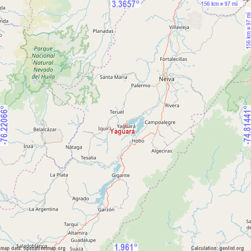
Yaguará GPS coordinates[2]
2° 39' 48.78" North, 75° 31' 3.108" West
| Map corner | latitude | longitude |
|---|---|---|
| Upper-left | 3.3657°, | -76.22066° |
| Center: | 2.66355°, | -75.51753° |
| Lower-right: | 1.961°, | -74.81441° |
| Map W x H: | 156.2×156.2 km | = 97.1×97.1mi |
| max Lat: | 13.38166° ⇑85.8% North |
| Yaguará: | 2.66355° |
| min Lat: | ⇓14.2% South -4.21528° |
| min Long | Yaguará | max Long |
| -81.70636° | -75.51753° | -67.06996° |
| W 33%⇐ | ⇒67% E |
Elevation
Elevation of Yaguará is 578 m = 1896 ft, and this is 571.3 m = 1874 ft below average elevation for this country.
| Max E: |
3342 m = 10965 ft | 62.7% |
| Avg. | 1149.3 m = 3771 ft | |
| Yaguará | 578 m = 1896 ft | |
Min E: |
1 m = 3 ft | 37.3% |
See also: Colombia elevation on elevation.city.
Geographical zone
Yaguará is located in North Torrid zone (between Equator and Tropic of Cancer). Distance of Equator is 296.2 km =184.1 mi to South.| Distance of | km | miles | from Yaguará |
|---|---|---|---|
| North Pole | 9710.9 | 6034.1 | to North |
| Arctic Circle | 7105 | 4414.8 | to North |
| Tropic Cancer | 2309.8 | 1435.2 | to North |
| Equator | 296.2 | 184.1 | to South |


Nearby cities:
15 places around Yaguará: (largest is in red/bold)
• Algeciras
27.1 km =16.8 mi,  124°
124°
• Belalcázar
50.6 km =31.4 mi,  267°
267°
• Campoalegre
21.7 km =13.5 mi,  83°
83°
• Gigante
31 km =19.3 mi,  186°
186°
• Hobo
11.7 km =7.3 mi,  139°
139°
• Neiva
39.3 km =24.4 mi,  41°
41°
• Nátaga
35 km =21.7 mi,  247°
247°
• Paicol
37.2 km =23.1 mi,  230°
230°
• Palermo
26.9 km =16.7 mi,  19°
19°
• Rivera
31.6 km =19.6 mi,  66°
66°
• Santa María
31.5 km =19.6 mi,  346°
346°
• Santa María
35.1 km =21.8 mi,  335°
335°
• Teruel
10.3 km =6.4 mi,  327°
327°
• Tesalia
30.7 km =19.1 mi, 229°
• Íquira
13.1 km =8.1 mi,  262°
262°
Sources, notices
• [Note1] Compared only with cities in Colombia existing in our database
• [Src1] Map data: © OpenStreetMap contributors (CC-BY-SA)
• [Src2] Other city data from geonames.org with taken over terms of usage.
• [Src3] Geographical zone / Annual Mean Temperature by Robert A. Rohde @ Wikipedia
