Belmira geodata
Belmira (Antioquia) is a seat of a second-order administrative division; located in Colombia in America/Bogota (GMT-5) time zone. With population of 1,388 people, there are 887 cities with bigger population in this country. Compared to other cities in Colombia, 70% of cities are located further ↓South; 71% of cities are located further →East and 88.8% of cities have lower elevation than Belmira. Note1


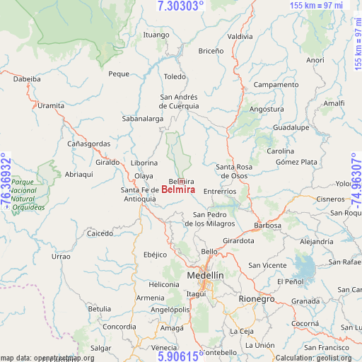
Belmira GPS coordinates[2]
6° 36' 18.288" North, 75° 39' 58.284" West
| Map corner | latitude | longitude |
|---|---|---|
| Upper-left | 7.30303°, | -76.36932° |
| Center: | 6.60508°, | -75.66619° |
| Lower-right: | 5.90615°, | -74.96307° |
| Map W x H: | 155.3×155.3 km | = 96.5×96.5mi |
| max Lat: | 13.38166° ⇑30% North |
| Belmira: | 6.60508° |
| min Lat: | ⇓70% South -4.21528° |
| min Long | Belmira | max Long |
| -81.70636° | -75.66619° | -67.06996° |
| W 29%⇐ | ⇒71% E |
Elevation
Elevation of Belmira is 2503 m = 8212 ft, and this is 1353.7 m = 4441 ft above average elevation for this country.
| Max E: |
3342 m = 10965 ft | 11.2% |
| Belmira | 2503 m 8212 ft | |
| Avg. | 1149.3 m = 3771 ft | |
Min E: |
1 m = 3 ft | 88.8% |
See also: Colombia elevation on elevation.city.
Geographical zone
Belmira is located in North Torrid zone (between Equator and Tropic of Cancer). Distance of Equator is 734.4 km =456.3 mi to South.| Distance of | km | miles | from Belmira |
|---|---|---|---|
| North Pole | 9272.6 | 5761.7 | to North |
| Arctic Circle | 6666.8 | 4142.6 | to North |
| Tropic Cancer | 1871.5 | 1162.9 | to North |
| Equator | 734.4 | 456.3 | to South |


Nearby cities:
15 places around Belmira: (largest is in red/bold)
• Bello
32.1 km =19.9 mi,  158°
158°
• Buriticá
29.5 km =18.3 mi,  295°
295°
• Donmatías
32.8 km =20.4 mi,  113°
113°
• Ebéjico
33 km =20.5 mi,  199°
199°
• Entrerríos
17.1 km =10.6 mi,  104°
104°
• Giraldo
32.7 km =20.3 mi,  284°
284°
• Liborina
18 km =11.2 mi, 296°
• Olaya
16.4 km =10.2 mi, 278°
• Sabanalarga
31.8 km =19.8 mi,  328°
328°
• San Jerónimo
19.2 km =11.9 mi, 200°
• San José de la Montaña
27.3 km =17 mi,  356°
356°
• San Pedro
20 km =12.4 mi,  143°
143°
• Santa Fe de Antioquia
18.7 km =11.6 mi,  253°
253°
• Santa Rosa de Osos
23.2 km =14.4 mi,  78°
78°
• Sopetrán
14.3 km =8.9 mi,  216°
216°
Sources, notices
• [Note1] Compared only with cities in Colombia existing in our database
• [Src1] Map data: © OpenStreetMap contributors (CC-BY-SA)
• [Src2] Other city data from geonames.org with taken over terms of usage.
• [Src3] Geographical zone / Annual Mean Temperature by Robert A. Rohde @ Wikipedia
