Cisneros geodata
Cisneros (Antioquia) is a seat of a second-order administrative division; located in Colombia in America/Bogota (GMT-5) time zone. With population of 8,204 people, there are 362 cities with bigger population in this country. Compared to other cities in Colombia, 68.9% of cities are located further ↓South; 55.9% of cities are located further →East and 52.4% of cities have higher elevation than Cisneros. Note1


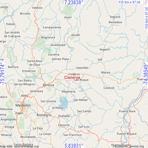
Cisneros GPS coordinates[2]
6° 32' 17.988" North, 75° 5' 18.996" West
| Map corner | latitude | longitude |
|---|---|---|
| Upper-left | 7.23638°, | -75.79174° |
| Center: | 6.53833°, | -75.08861° |
| Lower-right: | 5.83931°, | -74.38549° |
| Map W x H: | 155.3×155.3 km | = 96.5×96.5mi |
| max Lat: | 13.38166° ⇑31.1% North |
| Cisneros: | 6.53833° |
| min Lat: | ⇓68.9% South -4.21528° |
| min Long | Cisneros | max Long |
| -81.70636° | -75.08861° | -67.06996° |
| W 44.1%⇐ | ⇒55.9% E |
Elevation
Elevation of Cisneros is 1042 m = 3419 ft, and this is 107.3 m = 352 ft below average elevation for this country.
| Max E: |
3342 m = 10965 ft | 52.4% |
| Avg. | 1149.3 m = 3771 ft | |
| Cisneros | 1042 m = 3419 ft | |
Min E: |
1 m = 3 ft | 47.6% |
See also: Colombia elevation on elevation.city.
Geographical zone
Cisneros is located in North Torrid zone (between Equator and Tropic of Cancer). Distance of Equator is 727 km =451.7 mi to South.| Distance of | km | miles | from Cisneros |
|---|---|---|---|
| North Pole | 9280.1 | 5766.4 | to North |
| Arctic Circle | 6674.2 | 4147.2 | to North |
| Tropic Cancer | 1878.9 | 1167.5 | to North |
| Equator | 727 | 451.7 | to South |


Nearby cities:
15 places around Cisneros: (largest is in red/bold)
• Alejandría
18.8 km =11.7 mi,  197°
197°
• Barbosa
29 km =18 mi,  247°
247°
• Carolina
29.7 km =18.5 mi,  314°
314°
• Concepción
24.7 km =15.3 mi,  229°
229°
• Donmatías
34.3 km =21.3 mi,  260°
260°
• Guadalupe
35 km =21.7 mi,  331°
331°
• Guatapé
34.8 km =21.6 mi,  193°
193°
• Gómez Plata
21.5 km =13.4 mi,  317°
317°
• Maceo
33.3 km =20.7 mi,  87°
87°
• San Rafael
28 km =17.4 mi,  165°
165°
• San Roque
9.7 km =6 mi,  127°
127°
• San Vicente
39.1 km =24.3 mi,  223°
223°
• Santo Domingo
11.2 km =7 mi, 229°
• Yalí
31.9 km =19.8 mi,  61°
61°
• Yolombó
10.8 km =6.7 mi,  51°
51°
Sources, notices
• [Note1] Compared only with cities in Colombia existing in our database
• [Src1] Map data: © OpenStreetMap contributors (CC-BY-SA)
• [Src2] Other city data from geonames.org with taken over terms of usage.
• [Src3] Geographical zone / Annual Mean Temperature by Robert A. Rohde @ Wikipedia
