Entrerríos geodata
Entrerríos (Antioquia) is a seat of a second-order administrative division; located in Colombia in America/Bogota (GMT-5) time zone. With population of 3,462 people, there are 641 cities with bigger population in this country. Compared to other cities in Colombia, 69.5% of cities are located further ↓South; 66.8% of cities are located further →East and 85.6% of cities have lower elevation than Entrerríos. Note1


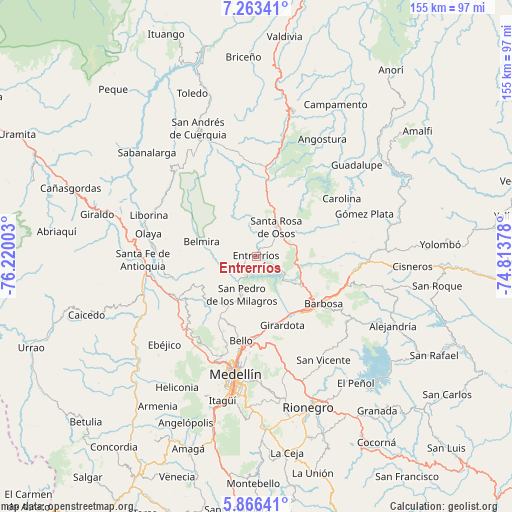
Entrerríos GPS coordinates[2]
6° 33' 55.44" North, 75° 31' 0.84" West
| Map corner | latitude | longitude |
|---|---|---|
| Upper-left | 7.26341°, | -76.22003° |
| Center: | 6.5654°, | -75.5169° |
| Lower-right: | 5.86641°, | -74.81378° |
| Map W x H: | 155.3×155.3 km | = 96.5×96.5mi |
| max Lat: | 13.38166° ⇑30.5% North |
| Entrerríos: | 6.5654° |
| min Lat: | ⇓69.5% South -4.21528° |
| min Long | Entrerríos | max Long |
| -81.70636° | -75.5169° | -67.06996° |
| W 33.2%⇐ | ⇒66.8% E |
Elevation
Elevation of Entrerríos is 2312 m = 7585 ft, and this is 1162.7 m = 3815 ft above average elevation for this country.
| Max E: |
3342 m = 10965 ft | 14.4% |
| Entrerríos | 2312 m 7585 ft | |
| Avg. | 1149.3 m = 3771 ft | |
Min E: |
1 m = 3 ft | 85.6% |
See also: Colombia elevation on elevation.city.
Geographical zone
Entrerríos is located in North Torrid zone (between Equator and Tropic of Cancer). Distance of Equator is 730 km =453.6 mi to South.| Distance of | km | miles | from Entrerríos |
|---|---|---|---|
| North Pole | 9277.1 | 5764.5 | to North |
| Arctic Circle | 6671.2 | 4145.3 | to North |
| Tropic Cancer | 1875.9 | 1165.6 | to North |
| Equator | 730 | 453.6 | to South |


Nearby cities:
15 places around Entrerríos: (largest is in red/bold)
• Barbosa
24.9 km =15.5 mi,  124°
124°
• Bello
25.8 km =16 mi,  190°
190°
• Belmira
17.1 km =10.6 mi,  284°
284°
• Carolina
31.4 km =19.5 mi,  55°
55°
• Concepción
34.3 km =21.3 mi, 123°
• Copacabana
24.4 km =15.2 mi,  177°
177°
• Donmatías
16.1 km =10 mi, 123°
• Girardota
22.2 km =13.8 mi,  160°
160°
• Guarne
32.7 km =20.3 mi,  165°
165°
• Olaya
33.4 km =20.8 mi, 281°
• San Jerónimo
27 km =16.8 mi,  239°
239°
• San Pedro
12.4 km =7.7 mi,  201°
201°
• Santa Fe de Antioquia
34.4 km =21.4 mi,  268°
268°
• Santa Rosa de Osos
11.1 km =6.9 mi,  34°
34°
• Sopetrán
26 km =16.2 mi,  254°
254°
Sources, notices
• [Note1] Compared only with cities in Colombia existing in our database
• [Src1] Map data: © OpenStreetMap contributors (CC-BY-SA)
• [Src2] Other city data from geonames.org with taken over terms of usage.
• [Src3] Geographical zone / Annual Mean Temperature by Robert A. Rohde @ Wikipedia
