Sabanilla geodata
Sabanilla (Alajuela) is a seat of a third-order administrative division; located in Costa Rica in America/Costa_Rica (GMT-6) time zone. With population of 1,015 people, there are 117 cities with bigger population in this country. Compared to other cities in Costa Rica, 70.1% of cities are located further ↓South; 61.2% of cities are located further →East and 87.3% of cities have lower elevation than Sabanilla. Note1


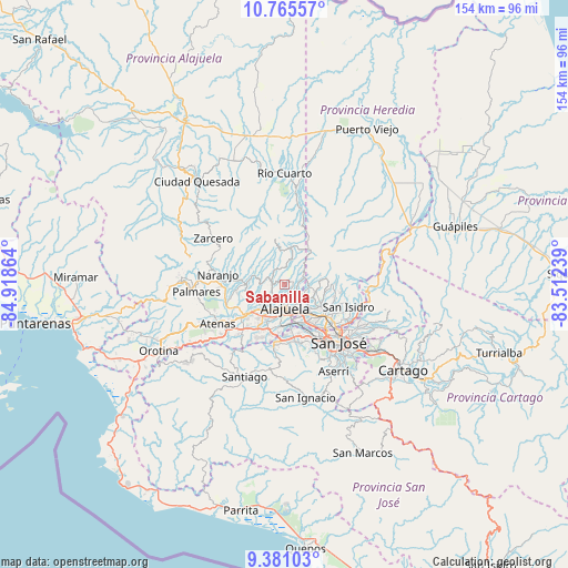
Sabanilla GPS coordinates[2]
10° 4' 26.544" North, 84° 12' 55.836" West
| Map corner | latitude | longitude |
|---|---|---|
| Upper-left | 10.76557°, | -84.91864° |
| Center: | 10.07404°, | -84.21551° |
| Lower-right: | 9.38103°, | -83.51239° |
| Map W x H: | 153.9×153.9 km | = 95.6×95.6mi |
| max Lat: | 11.07377° ⇑29.9% North |
| Sabanilla: | 10.07404° |
| min Lat: | ⇓70.1% South 8.53305° |
| min Long | Sabanilla | max Long |
| -85.64748° | -84.21551° | -82.62185° |
| W 38.8%⇐ | ⇒61.2% E |
Elevation
Elevation of Sabanilla is 1278 m = 4193 ft, and this is 543 m = 1781 ft above average elevation for this country.
| Max E: |
1844 m = 6050 ft | 12.7% |
| Sabanilla | 1278 m 4193 ft | |
| Avg. | 735 m = 2411 ft | |
Min E: |
7 m = 23 ft | 87.3% |
See also: Costa Rica elevation on elevation.city.
Geographical zone
Sabanilla is located in North Torrid zone (between Equator and Tropic of Cancer). Distance of Equator is 1120.1 km =696 mi to South.| Distance of | km | miles | from Sabanilla |
|---|---|---|---|
| North Pole | 8886.9 | 5522.1 | to North |
| Arctic Circle | 6281 | 3902.8 | to North |
| Tropic Cancer | 1485.8 | 923.2 | to North |
| Equator | 1120.1 | 696 | to South |


Nearby cities:
15 places around Sabanilla: (largest is in red/bold)
• Alajuela
6.4 km =4 mi,  176°
176°
• Carrillos
8.1 km =5 mi,  232°
232°
• Heredia
13.5 km =8.4 mi,  126°
126°
• La Asunción
11.5 km =7.1 mi,  155°
155°
• Llorente
10.7 km =6.6 mi,  141°
141°
• Mercedes
11.6 km =7.2 mi, 129°
• San Antonio
10.7 km =6.6 mi, 160°
• San Francisco
13 km =8.1 mi, 133°
• San Josecito
14.2 km =8.8 mi,  116°
116°
• San Juan
11.5 km =7.1 mi,  285°
285°
• San Pablo
15.7 km =9.8 mi, 123°
• San Rafael
14.3 km =8.9 mi, 118°
• Santa Ana
16.1 km =10 mi,  167°
167°
• Santo Domingo
6.7 km =4.2 mi,  99°
99°
• Sarchí
14.6 km =9.1 mi,  276°
276°
Sources, notices
• [Note1] Compared only with cities in Costa Rica existing in our database
• [Src1] Map data: © OpenStreetMap contributors (CC-BY-SA)
• [Src2] Other city data from geonames.org with taken over terms of usage.
• [Src3] Geographical zone / Annual Mean Temperature by Robert A. Rohde @ Wikipedia
