San Juan geodata
San Juan (Alajuela) is a populated place; located in Costa Rica in America/Costa_Rica (GMT-6) time zone. With population of 7,729 people, there are 61 cities with bigger population in this country. Compared to other cities in Costa Rica, 76.9% of cities are located further ↓South; 67.2% of cities are located further →East and 64.2% of cities have lower elevation than San Juan. Note1


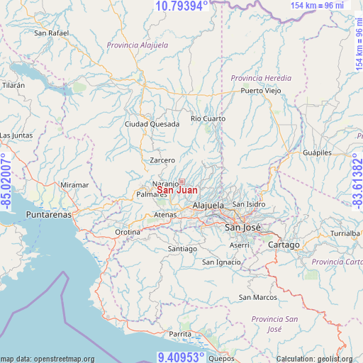
San Juan GPS coordinates[2]
10° 6' 8.928" North, 84° 19' 0.984" West
| Map corner | latitude | longitude |
|---|---|---|
| Upper-left | 10.79394°, | -85.02007° |
| Center: | 10.10248°, | -84.31694° |
| Lower-right: | 9.40953°, | -83.61382° |
| Map W x H: | 153.9×153.9 km | = 95.6×95.6mi |
| max Lat: | 11.07377° ⇑23.1% North |
| San Juan: | 10.10248° |
| min Lat: | ⇓76.9% South 8.53305° |
| min Long | San Juan | max Long |
| -85.64748° | -84.31694° | -82.62185° |
| W 32.8%⇐ | ⇒67.2% E |
Elevation
Elevation of San Juan is 1090 m = 3576 ft, and this is 355 m = 1165 ft above average elevation for this country.
| Max E: |
1844 m = 6050 ft | 35.8% |
| San Juan | 1090 m 3576 ft | |
| Avg. | 735 m = 2411 ft | |
Min E: |
7 m = 23 ft | 64.2% |
See also: Costa Rica elevation on elevation.city.
Geographical zone
San Juan is located in North Torrid zone (between Equator and Tropic of Cancer). Distance of Equator is 1123.3 km =698 mi to South.| Distance of | km | miles | from San Juan |
|---|---|---|---|
| North Pole | 8883.8 | 5520.1 | to North |
| Arctic Circle | 6277.9 | 3900.9 | to North |
| Tropic Cancer | 1482.6 | 921.2 | to North |
| Equator | 1123.3 | 698 | to South |


Nearby cities:
15 places around San Juan: (largest is in red/bold)
• Alajuela
15 km =9.3 mi,  129°
129°
• Atenas
15.7 km =9.8 mi,  205°
205°
• Barrio Jesús
18.3 km =11.4 mi,  218°
218°
• Carrillos
9.4 km =5.8 mi,  150°
150°
• Esquipulas
12.7 km =7.9 mi,  246°
246°
• Laguna
15 km =9.3 mi,  322°
322°
• Naranjo
6.7 km =4.2 mi,  266°
266°
• Río Segundo
16 km =9.9 mi,  14°
14°
• Sabanilla
11.5 km =7.1 mi,  105°
105°
• San Rafael
17.6 km =10.9 mi,  255°
255°
• San Ramón
16.9 km =10.5 mi, 264°
• Santiago
16.5 km =10.3 mi,  237°
237°
• Santo Domingo
18.2 km =11.3 mi,  103°
103°
• Sarchí
3.6 km =2.2 mi, 246°
• Zarcero
12.3 km =7.6 mi, 318°
Sources, notices
• [Note1] Compared only with cities in Costa Rica existing in our database
• [Src1] Map data: © OpenStreetMap contributors (CC-BY-SA)
• [Src2] Other city data from geonames.org with taken over terms of usage.
• [Src3] Geographical zone / Annual Mean Temperature by Robert A. Rohde @ Wikipedia
