Jiguaní geodata
Jiguaní (Granma) is a seat of a second-order administrative division; located in Cuba in America/Havana (GMT-4) time zone. With population of 41,106 people, there are 62 cities with bigger population in this country. Compared to other cities in Cuba, 87.8% of cities are located further ↑North; 84.5% of cities are located further ←West and 87.8% of cities have lower elevation than Jiguaní. Note1


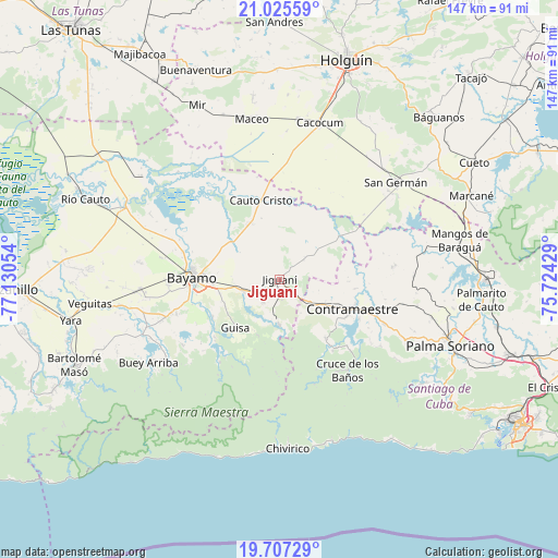
Jiguaní GPS coordinates[2]
20° 22' 4.26" North, 76° 25' 38.676" West
| Map corner | latitude | longitude |
|---|---|---|
| Upper-left | 21.02559°, | -77.13054° |
| Center: | 20.36785°, | -76.42741° |
| Lower-right: | 19.70729°, | -75.72429° |
| Map W x H: | 146.6×146.6 km | = 91.1×91.1mi |
| max Lat: | 23.15917° ⇑87.8% North |
| Jiguaní: | 20.36785° |
| min Lat: | ⇓12.2% South 19.90553° |
| min Long | Jiguaní | max Long |
| -84.28599° | -76.42741° | -74.15181° |
| W 84.5%⇐ | ⇒15.5% E |
Elevation
Elevation of Jiguaní is 122 m = 400 ft, and this is 53.4 m = 175 ft above average elevation for this country.
| Max E: |
761 m = 2497 ft | 12.2% |
| Jiguaní | 122 m 400 ft | |
| Avg. | 68.6 m = 225 ft | |
Min E: |
3 m = 10 ft | 87.8% |
See also: Jiguaní elevation on elevation.city.
Geographical zone
Jiguaní is located in North Torrid zone (between Equator and Tropic of Cancer). Distance of this Northern Tropic circle is 341.2 km =212 mi to North.| Distance of | km | miles | from Jiguaní |
|---|---|---|---|
| North Pole | 7742.4 | 4810.9 | to North |
| Arctic Circle | 5136.5 | 3191.7 | to North |
| Tropic Cancer | 341.2 | 212 | to North |
| Equator | 2264.7 | 1407.2 | to South |


Nearby cities:
15 places around Jiguaní: (largest is in red/bold)
• Bartolomé Masó
58.3 km =36.2 mi,  247°
247°
• Bayamo
22.5 km =14 mi,  271°
271°
• Buey Arriba
40.7 km =25.3 mi,  237°
237°
• Báguanos
59.7 km =37.1 mi,  44°
44°
• Cacocum
42.5 km =26.4 mi,  14°
14°
• Cauto Cristo
21.6 km =13.4 mi,  347°
347°
• Contramaestre
20.5 km =12.7 mi,  111°
111°
• Cueto
60.5 km =37.6 mi,  58°
58°
• El Cobre
61.5 km =38.2 mi,  125°
125°
• Guisa
17.1 km =10.6 mi,  222°
222°
• Holguín
60.2 km =37.4 mi,  16°
16°
• Palma Soriano
48.5 km =30.1 mi, 111°
• Río Cauto
55.3 km =34.4 mi,  292°
292°
• San Germán
40 km =24.9 mi,  49°
49°
• Yara
55.6 km =34.5 mi,  259°
259°
Sources, notices
• [Note1] Compared only with cities in Cuba existing in our database
• [Src1] Map data: © OpenStreetMap contributors (CC-BY-SA)
• [Src2] Other city data from geonames.org with taken over terms of usage.
• [Src3] Geographical zone / Annual Mean Temperature by Robert A. Rohde @ Wikipedia
