Ziesar geodata
Ziesar (Brandenburg) is a populated place; located in Germany in Europe/Berlin (GMT+1) time zone. With population of 2,875 people, there are 4120 cities with bigger population in this country. Compared to other cities in Germany, 74.8% of cities are located further ↓South; 85.7% of cities are located further ←West and 77.5% of cities have higher elevation than Ziesar. Note1
Administrative division(s):
- Level 1: Brandenburg
- Level 3: Landkreis Potsdam-Mittelmark
- Level 4: Ziesar


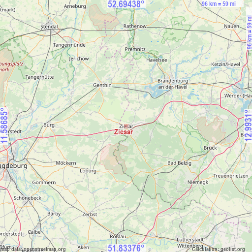
Ziesar GPS coordinates[2]
52° 15' 58.176" North, 12° 17' 23.892" East
| Map corner | latitude | longitude |
|---|---|---|
| Upper-left | 52.69438°, | 11.58685° |
| Center: | 52.26616°, | 12.28997° |
| Lower-right: | 51.83376°, | 12.9931° |
| Map W x H: | 95.7×95.7 km | = 59.5×59.5mi |
| max Lat: | 55.01917° ⇑25.2% North |
| Ziesar: | 52.26616° |
| min Lat: | ⇓74.8% South 47.40724° |
| min Long | Ziesar | max Long |
| 5.92978° | 12.28997° | 14.98853° |
| W 85.7%⇐ | ⇒14.3% E |
Elevation
Elevation of Ziesar is 54 m = 177 ft, and this is 195.1 m = 640 ft below average elevation for this country.
| Max E: |
1256 m = 4121 ft | 77.5% |
| Avg. | 249.1 m = 817 ft | |
| Ziesar | 54 m = 177 ft | |
Min E: |
-5 m = -16 ft | 22.5% |
See also: Germany elevation on elevation.city.
Geographical zone
Ziesar is located in North temperate zone (between Tropic of Cancer and the Arctic Circle). Distance of this North polar circle is 1589.7 km =987.8 mi to North.| Distance of | km | miles | from Ziesar |
|---|---|---|---|
| North Pole | 4195.6 | 2607 | to North |
| Arctic Circle | 1589.7 | 987.8 | to North |
| Tropic Cancer | 3205.5 | 1991.8 | to South |
| Equator | 5811.5 | 3611.1 | to South |


Nearby cities:
15 places around Ziesar: (largest is in red/bold)
• Bensdorf
17 km =10.6 mi,  9°
9°
• Genthin
18 km =11.2 mi,  330°
330°
• Gladau
14.2 km =8.8 mi,  287°
287°
• Gräben
10.4 km =6.5 mi,  110°
110°
• Görzke
12 km =7.5 mi,  151°
151°
• Hohenziatz
18.9 km =11.7 mi,  240°
240°
• Kade
12.7 km =7.9 mi,  352°
352°
• Karow
9 km =5.6 mi, 348°
• Mützel
14.8 km =9.2 mi, 328°
• Roßdorf
18.7 km =11.6 mi,  342°
342°
• Theeßen
16.7 km =10.4 mi,  260°
260°
• Tucheim
7.6 km =4.7 mi, 289°
• Wenzlow
11.5 km =7.1 mi,  70°
70°
• Wollin
12.2 km =7.6 mi,  80°
80°
• Wusterwitz
12.9 km =8 mi,  29°
29°
Sources, notices
• [Note1] Compared only with cities in Germany existing in our database
• [Src1] Map data: © OpenStreetMap contributors (CC-BY-SA)
• [Src2] Other city data from geonames.org with taken over terms of usage.
• [Src3] Geographical zone / Annual Mean Temperature by Robert A. Rohde @ Wikipedia
