Kade geodata
Kade (Saxony-Anhalt) is a populated place; located in Germany in Europe/Berlin (GMT+2) time zone. With population of 723 people, there are 8223 cities with bigger population in this country. Compared to other cities in Germany, 76% of cities are located further ↓South; 85.4% of cities are located further ←West and 84.1% of cities have higher elevation than Kade. Note1


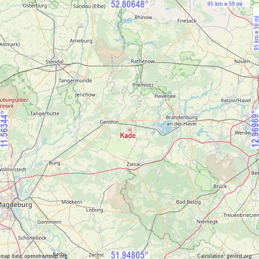
Kade GPS coordinates[2]
52° 22' 45.66" North, 12° 15' 59.616" East
| Map corner | latitude | longitude |
|---|---|---|
| Upper-left | 52.80648°, | 11.56344° |
| Center: | 52.37935°, | 12.26656° |
| Lower-right: | 51.94805°, | 12.96969° |
| Map W x H: | 95.4×95.4 km | = 59.3×59.3mi |
| max Lat: | 55.01917° ⇑24% North |
| Kade: | 52.37935° |
| min Lat: | ⇓76% South 47.40724° |
| min Long | Kade | max Long |
| 5.92978° | 12.26656° | 14.98853° |
| W 85.4%⇐ | ⇒14.6% E |
Elevation
Elevation of Kade is 37 m = 121 ft, and this is 212.1 m = 696 ft below average elevation for this country.
| Max E: |
1256 m = 4121 ft | 84.1% |
| Avg. | 249.1 m = 817 ft | |
| Kade | 37 m = 121 ft | |
Min E: |
-5 m = -16 ft | 15.9% |
See also: Germany elevation on elevation.city.
Geographical zone
Kade is located in North temperate zone (between Tropic of Cancer and the Arctic Circle). Distance of this North polar circle is 1577.1 km =980 mi to North.| Distance of | km | miles | from Kade |
|---|---|---|---|
| North Pole | 4183 | 2599.2 | to North |
| Arctic Circle | 1577.1 | 980 | to North |
| Tropic Cancer | 3218.1 | 1999.6 | to South |
| Equator | 5824 | 3618.9 | to South |


Nearby cities:
15 places around Kade: (largest is in red/bold)
• Bensdorf
6.1 km =3.8 mi,  47°
47°
• Brettin
7.7 km =4.8 mi,  312°
312°
• Genthin
7.9 km =4.9 mi,  292°
292°
• Gladau
14.6 km =9.1 mi,  235°
235°
• Karow
3.8 km =2.4 mi,  183°
183°
• Mützel
6.2 km =3.9 mi,  269°
269°
• Premnitz
17.8 km =11.1 mi,  18°
18°
• Redekin
16.2 km =10.1 mi, 307°
• Roßdorf
6.6 km =4.1 mi,  323°
323°
• Schlagenthin
9.5 km =5.9 mi,  5°
5°
• Tucheim
11.5 km =7.1 mi,  209°
209°
• Wenzlow
15.3 km =9.5 mi,  125°
125°
• Wollin
17.3 km =10.7 mi, 128°
• Wusterwitz
8.2 km =5.1 mi,  99°
99°
• Ziesar
12.7 km =7.9 mi,  172°
172°
Sources, notices
• [Note1] Compared only with cities in Germany existing in our database
• [Src1] Map data: © OpenStreetMap contributors (CC-BY-SA)
• [Src2] Other city data from geonames.org with taken over terms of usage.
• [Src3] Geographical zone / Annual Mean Temperature by Robert A. Rohde @ Wikipedia
