Wollin geodata
Wollin (Brandenburg) is a seat of a fourth-order administrative division; located in Germany in Europe/Berlin (GMT+2) time zone. With population of 972 people, there are 7264 cities with bigger population in this country. Compared to other cities in Germany, 75% of cities are located further ↓South; 87.7% of cities are located further ←West and 83.2% of cities have higher elevation than Wollin. Note1
Administrative division(s):
- Level 1: Brandenburg
- Level 3: Landkreis Potsdam-Mittelmark
- Level 4: Wollin


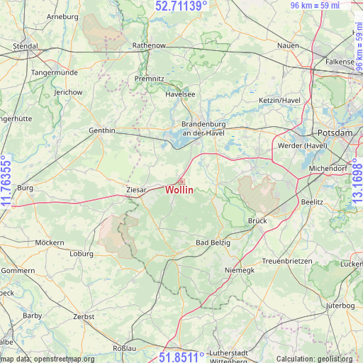
Wollin GPS coordinates[2]
52° 16' 59.988" North, 12° 28' 0.012" East
| Map corner | latitude | longitude |
|---|---|---|
| Upper-left | 52.71139°, | 11.76355° |
| Center: | 52.28333°, | 12.46667° |
| Lower-right: | 51.8511°, | 13.1698° |
| Map W x H: | 95.7×95.7 km | = 59.5×59.5mi |
| max Lat: | 55.01917° ⇑25% North |
| Wollin: | 52.28333° |
| min Lat: | ⇓75% South 47.40724° |
| min Long | Wollin | max Long |
| 5.92978° | 12.46667° | 14.98853° |
| W 87.7%⇐ | ⇒12.3% E |
Elevation
Elevation of Wollin is 39 m = 128 ft, and this is 210.1 m = 689 ft below average elevation for this country.
| Max E: |
1256 m = 4121 ft | 83.2% |
| Avg. | 249.1 m = 817 ft | |
| Wollin | 39 m = 128 ft | |
Min E: |
-5 m = -16 ft | 16.8% |
See also: Germany elevation on elevation.city.
Geographical zone
Wollin is located in North temperate zone (between Tropic of Cancer and the Arctic Circle). Distance of this North polar circle is 1587.8 km =986.6 mi to North.| Distance of | km | miles | from Wollin |
|---|---|---|---|
| North Pole | 4193.7 | 2605.8 | to North |
| Arctic Circle | 1587.8 | 986.6 | to North |
| Tropic Cancer | 3207.4 | 1993 | to South |
| Equator | 5813.4 | 3612.3 | to South |


Nearby cities:
15 places around Wollin: (largest is in red/bold)
• Bad Belzig
17.9 km =11.1 mi,  151°
151°
• Bensdorf
17.4 km =10.8 mi,  328°
328°
• Brandenburg an der Havel
15.9 km =9.9 mi,  20°
20°
• Golzow
9.1 km =5.7 mi,  94°
94°
• Gräben
6 km =3.7 mi,  202°
202°
• Görzke
13.9 km =8.6 mi,  206°
206°
• Kade
17.3 km =10.7 mi,  308°
308°
• Karow
15.5 km =9.6 mi,  296°
296°
• Kloster Lehnin
19.2 km =11.9 mi,  77°
77°
• Mützel
22.5 km =14 mi, 298°
• Tucheim
19.2 km =11.9 mi,  271°
271°
• Wenzlow
2.2 km =1.4 mi, 328°
• Wiesenburg
18.8 km =11.7 mi,  182°
182°
• Wusterwitz
10.8 km =6.7 mi, 329°
• Ziesar
12.2 km =7.6 mi,  260°
260°
Sources, notices
• [Note1] Compared only with cities in Germany existing in our database
• [Src1] Map data: © OpenStreetMap contributors (CC-BY-SA)
• [Src2] Other city data from geonames.org with taken over terms of usage.
• [Src3] Geographical zone / Annual Mean Temperature by Robert A. Rohde @ Wikipedia
