Wusterwitz geodata
Wusterwitz (Brandenburg) is a seat of a fourth-order administrative division; located in Germany in Europe/Berlin (GMT+2) time zone. With population of 3,184 people, there are 3841 cities with bigger population in this country. Compared to other cities in Germany, 75.8% of cities are located further ↓South; 86.9% of cities are located further ←West and 86.3% of cities have higher elevation than Wusterwitz. Note1
Administrative division(s):
- Level 1: Brandenburg
- Level 3: Landkreis Potsdam-Mittelmark
- Level 4: Wusterwitz


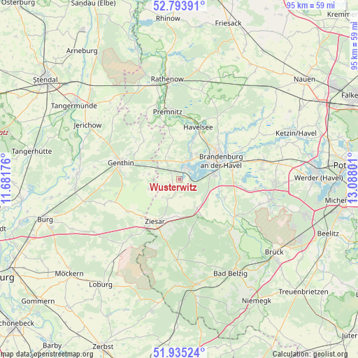
Wusterwitz GPS coordinates[2]
52° 21' 59.976" North, 12° 23' 5.568" East
| Map corner | latitude | longitude |
|---|---|---|
| Upper-left | 52.79391°, | 11.68176° |
| Center: | 52.36666°, | 12.38488° |
| Lower-right: | 51.93524°, | 13.08801° |
| Map W x H: | 95.5×95.5 km | = 59.3×59.3mi |
| max Lat: | 55.01917° ⇑24.2% North |
| Wusterwitz: | 52.36666° |
| min Lat: | ⇓75.8% South 47.40724° |
| min Long | Wusterwitz | max Long |
| 5.92978° | 12.38488° | 14.98853° |
| W 86.9%⇐ | ⇒13.1% E |
Elevation
Elevation of Wusterwitz is 32 m = 105 ft, and this is 217.1 m = 712 ft below average elevation for this country.
| Max E: |
1256 m = 4121 ft | 86.3% |
| Avg. | 249.1 m = 817 ft | |
| Wusterwitz | 32 m = 105 ft | |
Min E: |
-5 m = -16 ft | 13.7% |
See also: Germany elevation on elevation.city.
Geographical zone
Wusterwitz is located in North temperate zone (between Tropic of Cancer and the Arctic Circle). Distance of this North polar circle is 1578.5 km =980.8 mi to North.| Distance of | km | miles | from Wusterwitz |
|---|---|---|---|
| North Pole | 4184.4 | 2600.1 | to North |
| Arctic Circle | 1578.5 | 980.8 | to North |
| Tropic Cancer | 3216.7 | 1998.8 | to South |
| Equator | 5822.6 | 3618 | to South |


Nearby cities:
15 places around Wusterwitz: (largest is in red/bold)
• Bensdorf
6.6 km =4.1 mi,  327°
327°
• Brandenburg an der Havel
12.5 km =7.8 mi,  63°
63°
• Brettin
15.3 km =9.5 mi,  295°
295°
• Genthin
15.9 km =9.9 mi,  286°
286°
• Golzow
17.8 km =11.1 mi,  124°
124°
• Gräben
15.2 km =9.4 mi,  167°
167°
• Kade
8.2 km =5.1 mi,  279°
279°
• Karow
8.6 km =5.3 mi,  253°
253°
• Mützel
14.3 km =8.9 mi, 275°
• Roßdorf
13.7 km =8.5 mi, 299°
• Schlagenthin
13 km =8.1 mi, 326°
• Tucheim
16.1 km =10 mi,  237°
237°
• Wenzlow
8.6 km =5.3 mi,  149°
149°
• Wollin
10.8 km =6.7 mi, 149°
• Ziesar
12.9 km =8 mi,  209°
209°
Sources, notices
• [Note1] Compared only with cities in Germany existing in our database
• [Src1] Map data: © OpenStreetMap contributors (CC-BY-SA)
• [Src2] Other city data from geonames.org with taken over terms of usage.
• [Src3] Geographical zone / Annual Mean Temperature by Robert A. Rohde @ Wikipedia
