Winterberg geodata
Winterberg (North Rhine-Westphalia) is a populated place; located in Germany in Europe/Berlin (GMT+2) time zone. With population of 14,601 people, there are 1086 cities with bigger population in this country. Compared to other cities in Germany, 61.4% of cities are located further ↓South; 70.7% of cities are located further →East and 97.4% of cities have lower elevation than Winterberg. Note1
Administrative division(s):
- Level 1: North Rhine-Westphalia
- Level 2: Regierungsbezirk Arnsberg
- Level 3: Hochsauerlandkreis
- Level 4: Winterberg


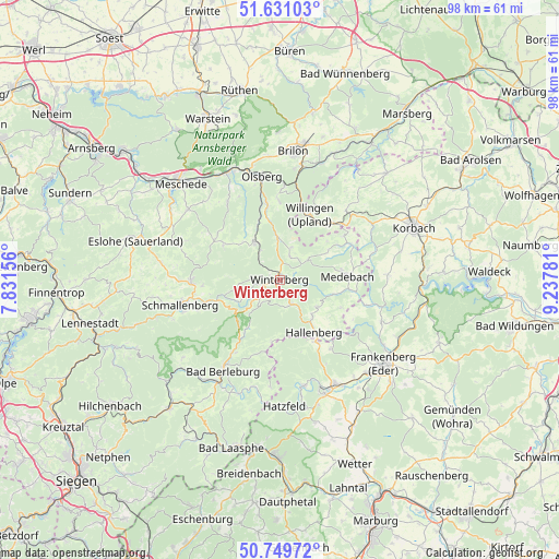
Winterberg GPS coordinates[2]
51° 11' 32.928" North, 8° 32' 4.848" East
| Map corner | latitude | longitude |
|---|---|---|
| Upper-left | 51.63103°, | 7.83156° |
| Center: | 51.19248°, | 8.53468° |
| Lower-right: | 50.74972°, | 9.23781° |
| Map W x H: | 98×98 km | = 60.9×60.9mi |
| max Lat: | 55.01917° ⇑38.6% North |
| Winterberg: | 51.19248° |
| min Lat: | ⇓61.4% South 47.40724° |
| min Long | Winterberg | max Long |
| 5.92978° | 8.53468° | 14.98853° |
| W 29.3%⇐ | ⇒70.7% E |
Elevation
Elevation of Winterberg is 679 m = 2228 ft, and this is 429.9 m = 1410 ft above average elevation for this country.
| Max E: |
1256 m = 4121 ft | 2.6% |
| Winterberg | 679 m 2228 ft | |
| Avg. | 249.1 m = 817 ft | |
Min E: |
-5 m = -16 ft | 97.4% |
See also: Germany elevation on elevation.city.
Geographical zone
Winterberg is located in North temperate zone (between Tropic of Cancer and the Arctic Circle). Distance of this North polar circle is 1709.1 km =1062 mi to North.| Distance of | km | miles | from Winterberg |
|---|---|---|---|
| North Pole | 4315 | 2681.2 | to North |
| Arctic Circle | 1709.1 | 1062 | to North |
| Tropic Cancer | 3086.2 | 1917.7 | to South |
| Equator | 5692.1 | 3536.9 | to South |


Nearby cities:
15 places around Winterberg: (largest is in red/bold)
• Allendorf
20.5 km =12.7 mi,  152°
152°
• Altenbüren
21.6 km =13.4 mi,  354°
354°
• Bad Berleburg
18.5 km =11.5 mi,  212°
212°
• Bad Fredeburg
15.7 km =9.8 mi,  268°
268°
• Battenberg
21.3 km =13.2 mi,  158°
158°
• Bestwig
20.9 km =13 mi,  333°
333°
• Brilon
22.6 km =14 mi,  6°
6°
• Bromskirchen
12.7 km =7.9 mi, 149°
• Hallenberg
10.8 km =6.7 mi, 146°
• Hatzfeld
22.2 km =13.8 mi,  178°
178°
• Medebach
12 km =7.5 mi,  87°
87°
• Olsberg
18.5 km =11.5 mi, 350°
• Schmallenberg
17.9 km =11.1 mi,  256°
256°
• Silbach
5.5 km =3.4 mi,  318°
318°
• Willingen
12.4 km =7.7 mi,  24°
24°
Sources, notices
• [Note1] Compared only with cities in Germany existing in our database
• [Src1] Map data: © OpenStreetMap contributors (CC-BY-SA)
• [Src2] Other city data from geonames.org with taken over terms of usage.
• [Src3] Geographical zone / Annual Mean Temperature by Robert A. Rohde @ Wikipedia
