Schmallenberg geodata
Schmallenberg (North Rhine-Westphalia) is a populated place; located in Germany in Europe/Berlin (GMT+2) time zone. With population of 26,132 people, there are 555 cities with bigger population in this country. Compared to other cities in Germany, 60.8% of cities are located further ↓South; 73.1% of cities are located further →East and 76.8% of cities have lower elevation than Schmallenberg. Note1
Administrative division(s):
- Level 1: North Rhine-Westphalia
- Level 2: Regierungsbezirk Arnsberg
- Level 3: Hochsauerlandkreis
- Level 4: Schmallenberg


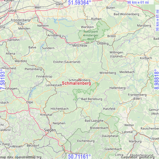
Schmallenberg GPS coordinates[2]
51° 9' 17.028" North, 8° 17' 6.18" East
| Map corner | latitude | longitude |
|---|---|---|
| Upper-left | 51.59364°, | 7.58193° |
| Center: | 51.15473°, | 8.28505° |
| Lower-right: | 50.71161°, | 8.98818° |
| Map W x H: | 98.1×98.1 km | = 61×61mi |
| max Lat: | 55.01917° ⇑39.2% North |
| Schmallenberg: | 51.15473° |
| min Lat: | ⇓60.8% South 47.40724° |
| min Long | Schmallenberg | max Long |
| 5.92978° | 8.28505° | 14.98853° |
| W 26.9%⇐ | ⇒73.1% E |
Elevation
Elevation of Schmallenberg is 411 m = 1348 ft, and this is 161.9 m = 531 ft above average elevation for this country.
| Max E: |
1256 m = 4121 ft | 23.2% |
| Schmallenberg | 411 m 1348 ft | |
| Avg. | 249.1 m = 817 ft | |
Min E: |
-5 m = -16 ft | 76.8% |
See also: Germany elevation on elevation.city.
Geographical zone
Schmallenberg is located in North temperate zone (between Tropic of Cancer and the Arctic Circle). Distance of this North polar circle is 1713.3 km =1064.6 mi to North.| Distance of | km | miles | from Schmallenberg |
|---|---|---|---|
| North Pole | 4319.2 | 2683.8 | to North |
| Arctic Circle | 1713.3 | 1064.6 | to North |
| Tropic Cancer | 3082 | 1915.1 | to South |
| Equator | 5687.9 | 3534.3 | to South |


Nearby cities:
15 places around Schmallenberg: (largest is in red/bold)
• Bad Berleburg
13.6 km =8.5 mi,  146°
146°
• Bad Fredeburg
4.2 km =2.6 mi,  24°
24°
• Bamenohl
21 km =13 mi,  273°
273°
• Bestwig
24.3 km =15.1 mi, 19°
• Bromskirchen
24.8 km =15.4 mi,  105°
105°
• Erndtebrück
18.5 km =11.5 mi,  186°
186°
• Eslohe
13.6 km =8.5 mi,  323°
323°
• Finnentrop
21.8 km =13.5 mi, 273°
• Hallenberg
23.9 km =14.9 mi,  101°
101°
• Hilchenbach
21.4 km =13.3 mi,  214°
214°
• Kirchhundem
15.7 km =9.8 mi,  240°
240°
• Lennestadt
15.8 km =9.8 mi,  254°
254°
• Meschede
21.7 km =13.5 mi,  359°
359°
• Silbach
16.1 km =10 mi,  58°
58°
• Winterberg
17.9 km =11.1 mi,  76°
76°
Sources, notices
• [Note1] Compared only with cities in Germany existing in our database
• [Src1] Map data: © OpenStreetMap contributors (CC-BY-SA)
• [Src2] Other city data from geonames.org with taken over terms of usage.
• [Src3] Geographical zone / Annual Mean Temperature by Robert A. Rohde @ Wikipedia
