Winsen geodata
Winsen (Lower Saxony) is a seat of a fourth-order administrative division; located in Germany in Europe/Berlin (GMT+2) time zone. With population of 12,838 people, there are 1258 cities with bigger population in this country. Compared to other cities in Germany, 79.5% of cities are located further ↓South; 51.3% of cities are located further →East and 85.8% of cities have higher elevation than Winsen. Note1


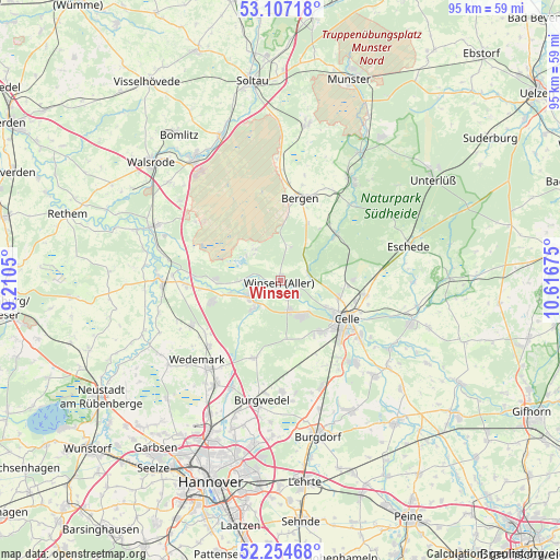
Winsen GPS coordinates[2]
52° 40' 58.836" North, 9° 54' 49.032" East
| Map corner | latitude | longitude |
|---|---|---|
| Upper-left | 53.10718°, | 9.2105° |
| Center: | 52.68301°, | 9.91362° |
| Lower-right: | 52.25468°, | 10.61675° |
| Map W x H: | 94.8×94.8 km | = 58.9×58.9mi |
| max Lat: | 55.01917° ⇑20.5% North |
| Winsen: | 52.68301° |
| min Lat: | ⇓79.5% South 47.40724° |
| min Long | Winsen | max Long |
| 5.92978° | 9.91362° | 14.98853° |
| W 48.7%⇐ | ⇒51.3% E |
Elevation
Elevation of Winsen is 33 m = 108 ft, and this is 216.1 m = 709 ft below average elevation for this country.
| Max E: |
1256 m = 4121 ft | 85.8% |
| Avg. | 249.1 m = 817 ft | |
| Winsen | 33 m = 108 ft | |
Min E: |
-5 m = -16 ft | 14.2% |
See also: Germany elevation on elevation.city.
Geographical zone
Winsen is located in North temperate zone (between Tropic of Cancer and the Arctic Circle). Distance of this North polar circle is 1543.4 km =959 mi to North.| Distance of | km | miles | from Winsen |
|---|---|---|---|
| North Pole | 4149.3 | 2578.3 | to North |
| Arctic Circle | 1543.4 | 959 | to North |
| Tropic Cancer | 3251.9 | 2020.6 | to South |
| Equator | 5857.8 | 3639.9 | to South |


Nearby cities:
15 places around Winsen: (largest is in red/bold)
• Adelheidsdorf
16.5 km =10.3 mi,  143°
143°
• Bergen
14.3 km =8.9 mi,  13°
13°
• Celle
13.1 km =8.1 mi,  120°
120°
• Eickeloh
21.3 km =13.2 mi,  283°
283°
• Elze
16.5 km =10.3 mi,  226°
226°
• Essel
18.4 km =11.4 mi,  272°
272°
• Habighorst
21.3 km =13.2 mi,  82°
82°
• Hademstorf
19.3 km =12 mi, 280°
• Hambühren
7.3 km =4.5 mi, 139°
• Hermannsburg
20.4 km =12.7 mi,  35°
35°
• Lindwedel
17.4 km =10.8 mi,  241°
241°
• Nienhagen
18.9 km =11.7 mi, 137°
• Schwarmstedt
20 km =12.4 mi, 268°
• Wietze
6.5 km =4 mi, 235°
• Winsen (Aller)
0.3 km =0.2 mi, 284°
Sources, notices
• [Note1] Compared only with cities in Germany existing in our database
• [Src1] Map data: © OpenStreetMap contributors (CC-BY-SA)
• [Src2] Other city data from geonames.org with taken over terms of usage.
• [Src3] Geographical zone / Annual Mean Temperature by Robert A. Rohde @ Wikipedia
