Nienhagen geodata
Nienhagen (Lower Saxony) is a seat of a fourth-order administrative division; located in Germany in Europe/Berlin (GMT+2) time zone. In our database, there are 11009 cities with bigger population. Compared to other cities in Germany, 78.2% of cities are located further ↓South; 51.7% of cities are located further ←West and 82.3% of cities have higher elevation than Nienhagen. Note1


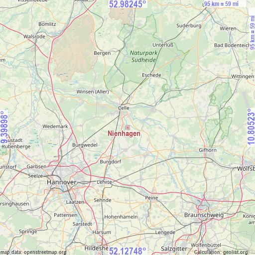
Nienhagen GPS coordinates[2]
52° 33' 25.38" North, 10° 6' 7.56" East
| Map corner | latitude | longitude |
|---|---|---|
| Upper-left | 52.98245°, | 9.39898° |
| Center: | 52.55705°, | 10.1021° |
| Lower-right: | 52.12748°, | 10.80523° |
| Map W x H: | 95.1×95.1 km | = 59.1×59.1mi |
| max Lat: | 55.01917° ⇑21.8% North |
| Nienhagen: | 52.55705° |
| min Lat: | ⇓78.2% South 47.40724° |
| min Long | Nienhagen | max Long |
| 5.92978° | 10.1021° | 14.98853° |
| W 51.7%⇐ | ⇒48.3% E |
Elevation
Elevation of Nienhagen is 41 m = 135 ft, and this is 208.1 m = 683 ft below average elevation for this country.
| Max E: |
1256 m = 4121 ft | 82.3% |
| Avg. | 249.1 m = 817 ft | |
| Nienhagen | 41 m = 135 ft | |
Min E: |
-5 m = -16 ft | 17.7% |
See also: Germany elevation on elevation.city.
Geographical zone
Nienhagen is located in North temperate zone (between Tropic of Cancer and the Arctic Circle). Distance of this North polar circle is 1557.4 km =967.7 mi to North.| Distance of | km | miles | from Nienhagen |
|---|---|---|---|
| North Pole | 4163.3 | 2587 | to North |
| Arctic Circle | 1557.4 | 967.7 | to North |
| Tropic Cancer | 3237.9 | 2011.9 | to South |
| Equator | 5843.8 | 3631.2 | to South |


Nearby cities:
15 places around Nienhagen: (largest is in red/bold)
• Adelheidsdorf
2.9 km =1.8 mi,  285°
285°
• Ahnsbeck
13.7 km =8.5 mi,  64°
64°
• Altmerdingsen
10.5 km =6.5 mi,  169°
169°
• Beedenbostel
14.3 km =8.9 mi,  48°
48°
• Bröckel
8.9 km =5.5 mi,  120°
120°
• Burgdorf
13.9 km =8.6 mi,  207°
207°
• Celle
7.4 km =4.6 mi,  348°
348°
• Eicklingen
5.6 km =3.5 mi,  97°
97°
• Hambühren
11.7 km =7.3 mi,  316°
316°
• Hänigsen
8.1 km =5 mi,  185°
185°
• Lachendorf
12 km =7.5 mi, 56°
• Langlingen
12.2 km =7.6 mi,  90°
90°
• Uetze
12.4 km =7.7 mi,  145°
145°
• Wathlingen
4 km =2.5 mi, 124°
• Wienhausen
6.4 km =4 mi,  66°
66°
In other languages:
- In German: Nienhagen (Landkreis Celle)
- In Italian: Nienhagen (Bassa Sassonia)
- In Russian: Нинхаген (Келле)
Sources, notices
• [Note1] Compared only with cities in Germany existing in our database
• [Src1] Map data: © OpenStreetMap contributors (CC-BY-SA)
• [Src2] Other city data from geonames.org with taken over terms of usage.
• [Src3] Geographical zone / Annual Mean Temperature by Robert A. Rohde @ Wikipedia
