Habighorst geodata
Habighorst (Lower Saxony) is a seat of a fourth-order administrative division; located in Germany in Europe/Berlin (GMT+2) time zone. In our database, there are 11009 cities with bigger population. Compared to other cities in Germany, 79.7% of cities are located further ↓South; 53.9% of cities are located further ←West and 73.8% of cities have higher elevation than Habighorst. Note1


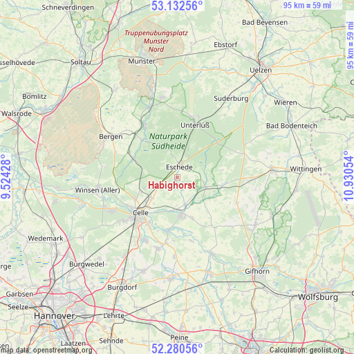
Habighorst GPS coordinates[2]
52° 42' 31.104" North, 10° 13' 38.676" East
| Map corner | latitude | longitude |
|---|---|---|
| Upper-left | 53.13256°, | 9.52428° |
| Center: | 52.70864°, | 10.22741° |
| Lower-right: | 52.28056°, | 10.93054° |
| Map W x H: | 94.7×94.7 km | = 58.8×58.8mi |
| max Lat: | 55.01917° ⇑20.3% North |
| Habighorst: | 52.70864° |
| min Lat: | ⇓79.7% South 47.40724° |
| min Long | Habighorst | max Long |
| 5.92978° | 10.22741° | 14.98853° |
| W 53.9%⇐ | ⇒46.1% E |
Elevation
Elevation of Habighorst is 68 m = 223 ft, and this is 181.1 m = 594 ft below average elevation for this country.
| Max E: |
1256 m = 4121 ft | 73.8% |
| Avg. | 249.1 m = 817 ft | |
| Habighorst | 68 m = 223 ft | |
Min E: |
-5 m = -16 ft | 26.2% |
See also: Germany elevation on elevation.city.
Geographical zone
Habighorst is located in North temperate zone (between Tropic of Cancer and the Arctic Circle). Distance of this North polar circle is 1540.5 km =957.2 mi to North.| Distance of | km | miles | from Habighorst |
|---|---|---|---|
| North Pole | 4146.4 | 2576.5 | to North |
| Arctic Circle | 1540.5 | 957.2 | to North |
| Tropic Cancer | 3254.7 | 2022.4 | to South |
| Equator | 5860.7 | 3641.7 | to South |


Nearby cities:
15 places around Habighorst: (largest is in red/bold)
• Ahnsbeck
11.6 km =7.2 mi,  160°
160°
• Beedenbostel
7.6 km =4.7 mi, 163°
• Celle
13.8 km =8.6 mi,  226°
226°
• Eldingen
7.7 km =4.8 mi,  111°
111°
• Eschede
3 km =1.9 mi,  10°
10°
• Groß Oesingen
17.3 km =10.7 mi, 113°
• Hermannsburg
16.6 km =10.3 mi,  326°
326°
• Hohne
16.8 km =10.4 mi,  143°
143°
• Höfer
3.2 km =2 mi,  151°
151°
• Lachendorf
10.3 km =6.4 mi,  171°
171°
• Langlingen
17.4 km =10.8 mi, 167°
• Scharnhorst
3.9 km =2.4 mi,  76°
76°
• Steinhorst
12 km =7.5 mi,  103°
103°
• Unterlüß
14.8 km =9.2 mi,  18°
18°
• Wienhausen
14.5 km =9 mi,  190°
190°
Sources, notices
• [Note1] Compared only with cities in Germany existing in our database
• [Src1] Map data: © OpenStreetMap contributors (CC-BY-SA)
• [Src2] Other city data from geonames.org with taken over terms of usage.
• [Src3] Geographical zone / Annual Mean Temperature by Robert A. Rohde @ Wikipedia
