Hademstorf geodata
Hademstorf (Lower Saxony) is a seat of a fourth-order administrative division; located in Germany in Europe/Berlin (GMT+2) time zone. With population of 924 people, there are 7442 cities with bigger population in this country. Compared to other cities in Germany, 79.8% of cities are located further ↓South; 55.6% of cities are located further →East and 87.3% of cities have higher elevation than Hademstorf. Note1


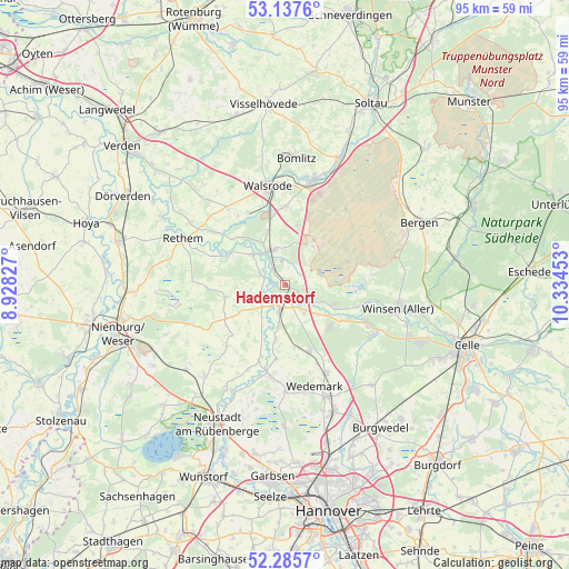
Hademstorf GPS coordinates[2]
52° 42' 49.428" North, 9° 37' 53.04" East
| Map corner | latitude | longitude |
|---|---|---|
| Upper-left | 53.1376°, | 8.92827° |
| Center: | 52.71373°, | 9.6314° |
| Lower-right: | 52.2857°, | 10.33453° |
| Map W x H: | 94.7×94.7 km | = 58.8×58.8mi |
| max Lat: | 55.01917° ⇑20.2% North |
| Hademstorf: | 52.71373° |
| min Lat: | ⇓79.8% South 47.40724° |
| min Long | Hademstorf | max Long |
| 5.92978° | 9.6314° | 14.98853° |
| W 44.4%⇐ | ⇒55.6% E |
Elevation
Elevation of Hademstorf is 29 m = 95 ft, and this is 220.1 m = 722 ft below average elevation for this country.
| Max E: |
1256 m = 4121 ft | 87.3% |
| Avg. | 249.1 m = 817 ft | |
| Hademstorf | 29 m = 95 ft | |
Min E: |
-5 m = -16 ft | 12.7% |
See also: Germany elevation on elevation.city.
Geographical zone
Hademstorf is located in North temperate zone (between Tropic of Cancer and the Arctic Circle). Distance of this North polar circle is 1540 km =956.9 mi to North.| Distance of | km | miles | from Hademstorf |
|---|---|---|---|
| North Pole | 4145.8 | 2576.1 | to North |
| Arctic Circle | 1540 | 956.9 | to North |
| Tropic Cancer | 3255.3 | 2022.7 | to South |
| Equator | 5861.2 | 3642 | to South |


Nearby cities:
15 places around Hademstorf: (largest is in red/bold)
• Ahlden
7.4 km =4.6 mi,  313°
313°
• Bad Fallingbostel
17.5 km =10.9 mi,  14°
14°
• Böhme
13.5 km =8.4 mi,  304°
304°
• Eickeloh
2.4 km =1.5 mi,  316°
316°
• Elze
16.3 km =10.1 mi,  154°
154°
• Essel
2.6 km =1.6 mi,  164°
164°
• Frankenfeld
14.9 km =9.3 mi,  294°
294°
• Gilten
3.6 km =2.2 mi,  244°
244°
• Grethem
4.2 km =2.6 mi, 290°
• Hodenhagen
6.2 km =3.9 mi,  336°
336°
• Lindwedel
12.4 km =7.7 mi, 162°
• Schwarmstedt
4.1 km =2.5 mi,  193°
193°
• Steimbke
17.5 km =10.9 mi,  248°
248°
• Walsrode
16.6 km =10.3 mi,  350°
350°
• Wietze
15.3 km =9.5 mi,  117°
117°
Sources, notices
• [Note1] Compared only with cities in Germany existing in our database
• [Src1] Map data: © OpenStreetMap contributors (CC-BY-SA)
• [Src2] Other city data from geonames.org with taken over terms of usage.
• [Src3] Geographical zone / Annual Mean Temperature by Robert A. Rohde @ Wikipedia
