Winkelhaid geodata
Winkelhaid (Bavaria) is a seat of a fourth-order administrative division; located in Germany in Europe/Berlin (GMT+2) time zone. With population of 3,971 people, there are 3318 cities with bigger population in this country. Compared to other cities in Germany, 77.3% of cities are located further ↑North; 71.3% of cities are located further ←West and 78.5% of cities have lower elevation than Winkelhaid. Note1
Administrative division(s):
- Level 1: Bavaria
- Level 2: Regierungsbezirk Mittelfranken
- Level 3: Nürnberger Land
- Level 4: Winkelhaid


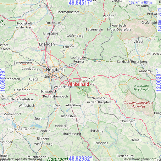
Winkelhaid GPS coordinates[2]
49° 23' 22.668" North, 11° 17' 55.968" East
| Map corner | latitude | longitude |
|---|---|---|
| Upper-left | 49.84517°, | 10.59576° |
| Center: | 49.38963°, | 11.29888° |
| Lower-right: | 48.92982°, | 12.00201° |
| Map W x H: | 101.8×101.8 km | = 63.3×63.3mi |
| max Lat: | 55.01917° ⇑77.3% North |
| Winkelhaid: | 49.38963° |
| min Lat: | ⇓22.7% South 47.40724° |
| min Long | Winkelhaid | max Long |
| 5.92978° | 11.29888° | 14.98853° |
| W 71.3%⇐ | ⇒28.7% E |
Elevation
Elevation of Winkelhaid is 423 m = 1388 ft, and this is 173.9 m = 571 ft above average elevation for this country.
| Max E: |
1256 m = 4121 ft | 21.5% |
| Winkelhaid | 423 m 1388 ft | |
| Avg. | 249.1 m = 817 ft | |
Min E: |
-5 m = -16 ft | 78.5% |
See also: Germany elevation on elevation.city.
Geographical zone
Winkelhaid is located in North temperate zone (between Tropic of Cancer and the Arctic Circle). Distance of this North polar circle is 1909.6 km =1186.6 mi to North.| Distance of | km | miles | from Winkelhaid |
|---|---|---|---|
| North Pole | 4515.4 | 2805.7 | to North |
| Arctic Circle | 1909.6 | 1186.6 | to North |
| Tropic Cancer | 2885.7 | 1793.1 | to South |
| Equator | 5491.6 | 3412.3 | to South |


Nearby cities:
15 places around Winkelhaid: (largest is in red/bold)
• Altdorf
4.3 km =2.7 mi,  96°
96°
• Berg bei Neumarkt in der Oberpfalz
12 km =7.5 mi,  122°
122°
• Burgthann
4.3 km =2.7 mi,  167°
167°
• Engelthal
11.7 km =7.3 mi,  38°
38°
• Feucht
6.3 km =3.9 mi,  256°
256°
• Leinburg
6.9 km =4.3 mi,  6°
6°
• Offenhausen
10.6 km =6.6 mi,  51°
51°
• Postbauer-Heng
10.3 km =6.4 mi,  155°
155°
• Pyrbaum
10.4 km =6.5 mi,  184°
184°
• Röthenbach an der Pegnitz
11.2 km =7 mi,  338°
338°
• Rückersdorf
12.6 km =7.8 mi, 342°
• Schwaig
11.4 km =7.1 mi,  321°
321°
• Schwarzenbruck
5.4 km =3.4 mi,  228°
228°
• Stöckelsberg
10.1 km =6.3 mi,  93°
93°
• Wendelstein
11.5 km =7.1 mi,  248°
248°
Sources, notices
• [Note1] Compared only with cities in Germany existing in our database
• [Src1] Map data: © OpenStreetMap contributors (CC-BY-SA)
• [Src2] Other city data from geonames.org with taken over terms of usage.
• [Src3] Geographical zone / Annual Mean Temperature by Robert A. Rohde @ Wikipedia
