Windhagen geodata
Windhagen (Rheinland-Pfalz) is a seat of a fourth-order administrative division; located in Germany in Europe/Berlin (GMT+2) time zone. With population of 4,433 people, there are 3072 cities with bigger population in this country. Compared to other cities in Germany, 50.5% of cities are located further ↓South; 89.1% of cities are located further →East and 64% of cities have lower elevation than Windhagen. Note1


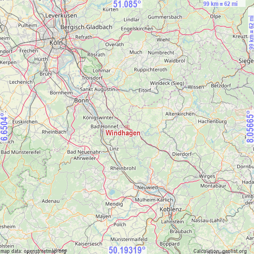
Windhagen GPS coordinates[2]
50° 38' 28.356" North, 7° 21' 12.672" East
| Map corner | latitude | longitude |
|---|---|---|
| Upper-left | 51.085°, | 6.6504° |
| Center: | 50.64121°, | 7.35352° |
| Lower-right: | 50.19319°, | 8.05665° |
| Map W x H: | 99.2×99.2 km | = 61.6×61.6mi |
| max Lat: | 55.01917° ⇑49.5% North |
| Windhagen: | 50.64121° |
| min Lat: | ⇓50.5% South 47.40724° |
| min Long | Windhagen | max Long |
| 5.92978° | 7.35352° | 14.98853° |
| W 10.9%⇐ | ⇒89.1% E |
Elevation
Elevation of Windhagen is 315 m = 1033 ft, and this is 65.9 m = 216 ft above average elevation for this country.
| Max E: |
1256 m = 4121 ft | 36% |
| Windhagen | 315 m 1033 ft | |
| Avg. | 249.1 m = 817 ft | |
Min E: |
-5 m = -16 ft | 64% |
See also: Germany elevation on elevation.city.
Geographical zone
Windhagen is located in North temperate zone (between Tropic of Cancer and the Arctic Circle). Distance of this North polar circle is 1770.4 km =1100.1 mi to North.| Distance of | km | miles | from Windhagen |
|---|---|---|---|
| North Pole | 4376.3 | 2719.3 | to North |
| Arctic Circle | 1770.4 | 1100.1 | to North |
| Tropic Cancer | 3024.9 | 1879.6 | to South |
| Equator | 5630.8 | 3498.8 | to South |


Nearby cities:
15 places around Windhagen: (largest is in red/bold)
• Asbach
5.3 km =3.3 mi,  57°
57°
• Bad Honnef
8.9 km =5.5 mi,  271°
271°
• Boseroth
8.6 km =5.3 mi,  321°
321°
• Breitscheid
9.2 km =5.7 mi,  136°
136°
• Bruchhausen
8.6 km =5.3 mi,  237°
237°
• Eulenberg
9.5 km =5.9 mi,  114°
114°
• Kalenborn
4 km =2.5 mi,  223°
223°
• Kasbach-Ohlenberg
8.9 km =5.5 mi, 223°
• Linz am Rhein
9.4 km =5.8 mi,  211°
211°
• Ockenfels
9.1 km =5.7 mi, 217°
• Peterslahr
8.4 km =5.2 mi, 108°
• Rheinbreitbach
8.9 km =5.5 mi,  252°
252°
• Roßbach
8.6 km =5.3 mi,  149°
149°
• Sankt Katharinen
6.8 km =4.2 mi,  161°
161°
• Vettelschoß
2.7 km =1.7 mi,  185°
185°
Sources, notices
• [Note1] Compared only with cities in Germany existing in our database
• [Src1] Map data: © OpenStreetMap contributors (CC-BY-SA)
• [Src2] Other city data from geonames.org with taken over terms of usage.
• [Src3] Geographical zone / Annual Mean Temperature by Robert A. Rohde @ Wikipedia
