Kalenborn geodata
Kalenborn (Rheinland-Pfalz) is a populated place; located in Germany in Europe/Berlin (GMT+2) time zone. With population of 715 people, there are 8253 cities with bigger population in this country. Compared to other cities in Germany, 50.2% of cities are located further ↑North; 89.7% of cities are located further →East and 69.4% of cities have lower elevation than Kalenborn. Note1
Administrative division(s):
- Level 1: Rheinland-Pfalz
- Level 3: Landkreis Neuwied
- Level 4: Vettelschoß


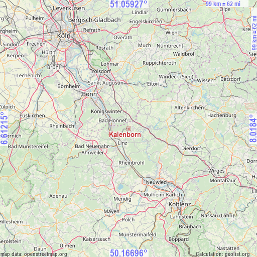
Kalenborn GPS coordinates[2]
50° 36' 54.828" North, 7° 18' 55.008" East
| Map corner | latitude | longitude |
|---|---|---|
| Upper-left | 51.05927°, | 6.61215° |
| Center: | 50.61523°, | 7.31528° |
| Lower-right: | 50.16696°, | 8.0184° |
| Map W x H: | 99.2×99.2 km | = 61.6×61.6mi |
| max Lat: | 55.01917° ⇑50.2% North |
| Kalenborn: | 50.61523° |
| min Lat: | ⇓49.8% South 47.40724° |
| min Long | Kalenborn | max Long |
| 5.92978° | 7.31528° | 14.98853° |
| W 10.3%⇐ | ⇒89.7% E |
Elevation
Elevation of Kalenborn is 354 m = 1161 ft, and this is 104.9 m = 344 ft above average elevation for this country.
| Max E: |
1256 m = 4121 ft | 30.6% |
| Kalenborn | 354 m 1161 ft | |
| Avg. | 249.1 m = 817 ft | |
Min E: |
-5 m = -16 ft | 69.4% |
See also: Germany elevation on elevation.city.
Geographical zone
Kalenborn is located in North temperate zone (between Tropic of Cancer and the Arctic Circle). Distance of this North polar circle is 1773.3 km =1101.9 mi to North.| Distance of | km | miles | from Kalenborn |
|---|---|---|---|
| North Pole | 4379.2 | 2721.1 | to North |
| Arctic Circle | 1773.3 | 1101.9 | to North |
| Tropic Cancer | 3022 | 1877.8 | to South |
| Equator | 5627.9 | 3497 | to South |


Nearby cities:
15 places around Kalenborn: (largest is in red/bold)
• Bad Honnef
6.9 km =4.3 mi,  296°
296°
• Bruchhausen
4.9 km =3 mi,  249°
249°
• Dattenberg
7 km =4.3 mi,  192°
192°
• Erpel
6.8 km =4.2 mi,  238°
238°
• Kasbach-Ohlenberg
4.9 km =3 mi,  224°
224°
• Leubsdorf
7.3 km =4.5 mi, 188°
• Linz am Rhein
5.6 km =3.5 mi,  202°
202°
• Ockenfels
5.2 km =3.2 mi,  212°
212°
• Remagen
7.4 km =4.6 mi, 236°
• Rheinbreitbach
5.8 km =3.6 mi,  271°
271°
• Roßbach
8.4 km =5.2 mi,  122°
122°
• Sankt Katharinen
6 km =3.7 mi,  126°
126°
• Unkel
7.1 km =4.4 mi, 253°
• Vettelschoß
2.5 km =1.6 mi,  86°
86°
• Windhagen
4 km =2.5 mi,  43°
43°
Sources, notices
• [Note1] Compared only with cities in Germany existing in our database
• [Src1] Map data: © OpenStreetMap contributors (CC-BY-SA)
• [Src2] Other city data from geonames.org with taken over terms of usage.
• [Src3] Geographical zone / Annual Mean Temperature by Robert A. Rohde @ Wikipedia
