Willmars geodata
Willmars (Bavaria) is a seat of a fourth-order administrative division; located in Germany in Europe/Berlin (GMT+2) time zone. With population of 707 people, there are 8283 cities with bigger population in this country. Compared to other cities in Germany, 52.8% of cities are located further ↑North; 54.3% of cities are located further ←West and 81% of cities have lower elevation than Willmars. Note1
Administrative division(s):
- Level 1: Bavaria
- Level 2: Regierungsbezirk Unterfranken
- Level 3: Landkreis Rhön-Grabfeld
- Level 4: Willmars


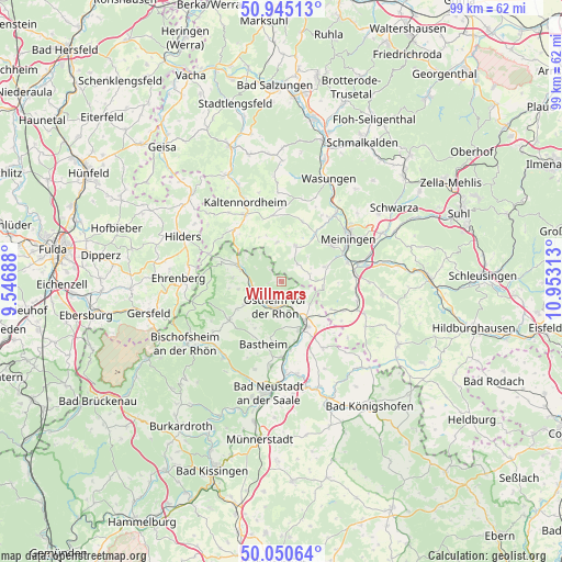
Willmars GPS coordinates[2]
50° 30' 0" North, 10° 15' 0" East
| Map corner | latitude | longitude |
|---|---|---|
| Upper-left | 50.94513°, | 9.54688° |
| Center: | 50.5°, | 10.25° |
| Lower-right: | 50.05064°, | 10.95313° |
| Map W x H: | 99.5×99.5 km | = 61.8×61.8mi |
| max Lat: | 55.01917° ⇑52.8% North |
| Willmars: | 50.5° |
| min Lat: | ⇓47.2% South 47.40724° |
| min Long | Willmars | max Long |
| 5.92978° | 10.25° | 14.98853° |
| W 54.3%⇐ | ⇒45.7% E |
Elevation
Elevation of Willmars is 440 m = 1444 ft, and this is 190.9 m = 626 ft above average elevation for this country.
| Max E: |
1256 m = 4121 ft | 19% |
| Willmars | 440 m 1444 ft | |
| Avg. | 249.1 m = 817 ft | |
Min E: |
-5 m = -16 ft | 81% |
See also: Germany elevation on elevation.city.
Geographical zone
Willmars is located in North temperate zone (between Tropic of Cancer and the Arctic Circle). Distance of this North polar circle is 1786.1 km =1109.8 mi to North.| Distance of | km | miles | from Willmars |
|---|---|---|---|
| North Pole | 4392 | 2729.1 | to North |
| Arctic Circle | 1786.1 | 1109.8 | to North |
| Tropic Cancer | 3009.2 | 1869.8 | to South |
| Equator | 5615.1 | 3489.1 | to South |


Nearby cities:
15 places around Willmars: (largest is in red/bold)
• Bastheim
11.5 km =7.1 mi,  196°
196°
• Erbenhausen
10.2 km =6.3 mi,  316°
316°
• Fladungen
7.7 km =4.8 mi,  287°
287°
• Hausen
8.8 km =5.5 mi,  274°
274°
• Henneberg
7.5 km =4.7 mi,  96°
96°
• Herpf
10.5 km =6.5 mi,  33°
33°
• Mellrichstadt
8.8 km =5.5 mi,  154°
154°
• Melpers
9 km =5.6 mi,  308°
308°
• Oberelsbach
11.5 km =7.1 mi,  235°
235°
• Oberkatz
11.2 km =7 mi,  353°
353°
• Oberstreu
11.1 km =6.9 mi,  166°
166°
• Ostheim vor der Rhön
4.7 km =2.9 mi, 197°
• Sondheim vor der Rhön
7.7 km =4.8 mi, 239°
• Stockheim
4.8 km =3 mi,  160°
160°
• Sülzfeld
8.2 km =5.1 mi,  71°
71°
Sources, notices
• [Note1] Compared only with cities in Germany existing in our database
• [Src1] Map data: © OpenStreetMap contributors (CC-BY-SA)
• [Src2] Other city data from geonames.org with taken over terms of usage.
• [Src3] Geographical zone / Annual Mean Temperature by Robert A. Rohde @ Wikipedia
