Wilkau-Haßlau geodata
Wilkau-Haßlau (Saxony) is a populated place; located in Germany in Europe/Berlin (GMT+2) time zone. With population of 11,850 people, there are 1387 cities with bigger population in this country. Compared to other cities in Germany, 51.4% of cities are located further ↓South; 88.1% of cities are located further ←West and 58.1% of cities have lower elevation than Wilkau-Haßlau. Note1


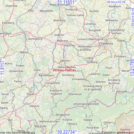
Wilkau-Haßlau GPS coordinates[2]
50° 40' 30.144" North, 12° 30' 53.352" East
| Map corner | latitude | longitude |
|---|---|---|
| Upper-left | 51.11851°, | 11.8117° |
| Center: | 50.67504°, | 12.51482° |
| Lower-right: | 50.22734°, | 13.21795° |
| Map W x H: | 99.1×99.1 km | = 61.6×61.6mi |
| max Lat: | 55.01917° ⇑48.6% North |
| Wilkau-Haßlau: | 50.67504° |
| min Lat: | ⇓51.4% South 47.40724° |
| min Long | Wilkau-Haßlau | max Long |
| 5.92978° | 12.51482° | 14.98853° |
| W 88.1%⇐ | ⇒11.9% E |
Elevation
Elevation of Wilkau-Haßlau is 279 m = 915 ft, and this is 29.9 m = 98 ft above average elevation for this country.
| Max E: |
1256 m = 4121 ft | 41.9% |
| Wilkau-Haßlau | 279 m 915 ft | |
| Avg. | 249.1 m = 817 ft | |
Min E: |
-5 m = -16 ft | 58.1% |
See also: Germany elevation on elevation.city.
Geographical zone
Wilkau-Haßlau is located in North temperate zone (between Tropic of Cancer and the Arctic Circle). Distance of this North polar circle is 1766.6 km =1097.7 mi to North.| Distance of | km | miles | from Wilkau-Haßlau |
|---|---|---|---|
| North Pole | 4372.5 | 2716.9 | to North |
| Arctic Circle | 1766.6 | 1097.7 | to North |
| Tropic Cancer | 3028.6 | 1881.9 | to South |
| Equator | 5634.5 | 3501.1 | to South |


Nearby cities:
15 places around Wilkau-Haßlau: (largest is in red/bold)
• Fraureuth
11.9 km =7.4 mi,  283°
283°
• Hartenstein
11 km =6.8 mi,  97°
97°
• Hartmannsdorf
11.1 km =6.9 mi,  326°
326°
• Hirschfeld
6.9 km =4.3 mi,  215°
215°
• Kirchberg
5.9 km =3.7 mi,  173°
173°
• Leubnitz
12.4 km =7.7 mi,  295°
295°
• Lichtenstein
12.2 km =7.6 mi,  41°
41°
• Lichtentanne
6.6 km =4.1 mi,  287°
287°
• Mülsen
9.1 km =5.7 mi,  23°
23°
• Neumark
11.3 km =7 mi,  261°
261°
• Reinsdorf
3.8 km =2.4 mi,  48°
48°
• Weißenborn
7.8 km =4.8 mi,  336°
336°
• Werdau
11.9 km =7.4 mi, 304°
• Wildenfels
6.7 km =4.2 mi, 96°
• Zwickau
6.1 km =3.8 mi, 342°
Sources, notices
• [Note1] Compared only with cities in Germany existing in our database
• [Src1] Map data: © OpenStreetMap contributors (CC-BY-SA)
• [Src2] Other city data from geonames.org with taken over terms of usage.
• [Src3] Geographical zone / Annual Mean Temperature by Robert A. Rohde @ Wikipedia
