Wilhermsdorf geodata
Wilhermsdorf (Bavaria) is a populated place; located in Germany in Europe/Berlin (GMT+2) time zone. With population of 5,105 people, there are 2787 cities with bigger population in this country. Compared to other cities in Germany, 76% of cities are located further ↑North; 62.7% of cities are located further ←West and 64.9% of cities have lower elevation than Wilhermsdorf. Note1
Administrative division(s):
- Level 1: Bavaria
- Level 2: Regierungsbezirk Mittelfranken
- Level 3: Landkreis Fürth
- Level 4: Wilhermsdorf, Markt


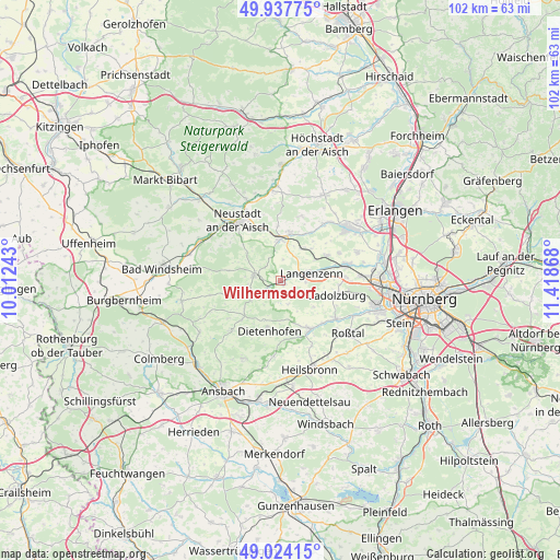
Wilhermsdorf GPS coordinates[2]
49° 28' 59.088" North, 10° 42' 55.98" East
| Map corner | latitude | longitude |
|---|---|---|
| Upper-left | 49.93775°, | 10.01243° |
| Center: | 49.48308°, | 10.71555° |
| Lower-right: | 49.02415°, | 11.41868° |
| Map W x H: | 101.6×101.6 km | = 63.1×63.1mi |
| max Lat: | 55.01917° ⇑76% North |
| Wilhermsdorf: | 49.48308° |
| min Lat: | ⇓24% South 47.40724° |
| min Long | Wilhermsdorf | max Long |
| 5.92978° | 10.71555° | 14.98853° |
| W 62.7%⇐ | ⇒37.3% E |
Elevation
Elevation of Wilhermsdorf is 320 m = 1050 ft, and this is 70.9 m = 233 ft above average elevation for this country.
| Max E: |
1256 m = 4121 ft | 35.1% |
| Wilhermsdorf | 320 m 1050 ft | |
| Avg. | 249.1 m = 817 ft | |
Min E: |
-5 m = -16 ft | 64.9% |
See also: Germany elevation on elevation.city.
Geographical zone
Wilhermsdorf is located in North temperate zone (between Tropic of Cancer and the Arctic Circle). Distance of this North polar circle is 1899.2 km =1180.1 mi to North.| Distance of | km | miles | from Wilhermsdorf |
|---|---|---|---|
| North Pole | 4505.1 | 2799.3 | to North |
| Arctic Circle | 1899.2 | 1180.1 | to North |
| Tropic Cancer | 2896.1 | 1799.6 | to South |
| Equator | 5502 | 3418.8 | to South |


Nearby cities:
15 places around Wilhermsdorf: (largest is in red/bold)
• Adelsdorf
2.6 km =1.6 mi,  236°
236°
• Ammerndorf
11.8 km =7.3 mi,  124°
124°
• Cadolzburg
10.4 km =6.5 mi,  106°
106°
• Dietenhofen
9.4 km =5.8 mi,  191°
191°
• Emskirchen
7.8 km =4.8 mi,  358°
358°
• Großhabersdorf
10.5 km =6.5 mi,  152°
152°
• Hagenbüchach
6.7 km =4.2 mi,  33°
33°
• Langenzenn
5.7 km =3.5 mi,  76°
76°
• Markt Erlbach
4.7 km =2.9 mi,  284°
284°
• Neuhof an der Zenn
5.8 km =3.6 mi, 240°
• Puschendorf
9.6 km =6 mi,  61°
61°
• Seukendorf
11.9 km =7.4 mi,  87°
87°
• Trautskirchen
9.2 km =5.7 mi,  252°
252°
• Tuchenbach
11.5 km =7.1 mi, 64°
• Wilhelmsdorf
9.2 km =5.7 mi,  9°
9°
Sources, notices
• [Note1] Compared only with cities in Germany existing in our database
• [Src1] Map data: © OpenStreetMap contributors (CC-BY-SA)
• [Src2] Other city data from geonames.org with taken over terms of usage.
• [Src3] Geographical zone / Annual Mean Temperature by Robert A. Rohde @ Wikipedia
