Wildflecken geodata
Wildflecken (Bavaria) is a populated place; located in Germany in Europe/Berlin (GMT+2) time zone. With population of 3,352 people, there are 3720 cities with bigger population in this country. Compared to other cities in Germany, 55.1% of cities are located further ↑North; 51.3% of cities are located further →East and 90.2% of cities have lower elevation than Wildflecken. Note1
Administrative division(s):
- Level 1: Bavaria
- Level 2: Regierungsbezirk Unterfranken
- Level 3: Landkreis Bad Kissingen
- Level 4: Wildflecken, Markt


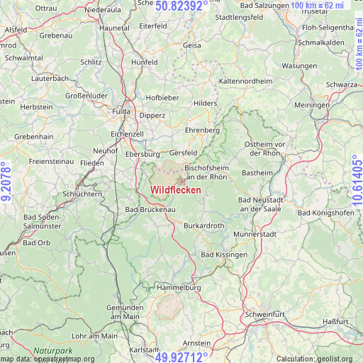
Wildflecken GPS coordinates[2]
50° 22' 39.504" North, 9° 54' 39.312" East
| Map corner | latitude | longitude |
|---|---|---|
| Upper-left | 50.82392°, | 9.2078° |
| Center: | 50.37764°, | 9.91092° |
| Lower-right: | 49.92712°, | 10.61405° |
| Map W x H: | 99.7×99.7 km | = 62×62mi |
| max Lat: | 55.01917° ⇑55.1% North |
| Wildflecken: | 50.37764° |
| min Lat: | ⇓44.9% South 47.40724° |
| min Long | Wildflecken | max Long |
| 5.92978° | 9.91092° | 14.98853° |
| W 48.7%⇐ | ⇒51.3% E |
Elevation
Elevation of Wildflecken is 516 m = 1693 ft, and this is 266.9 m = 876 ft above average elevation for this country.
| Max E: |
1256 m = 4121 ft | 9.8% |
| Wildflecken | 516 m 1693 ft | |
| Avg. | 249.1 m = 817 ft | |
Min E: |
-5 m = -16 ft | 90.2% |
See also: Germany elevation on elevation.city.
Geographical zone
Wildflecken is located in North temperate zone (between Tropic of Cancer and the Arctic Circle). Distance of this North polar circle is 1799.7 km =1118.3 mi to North.| Distance of | km | miles | from Wildflecken |
|---|---|---|---|
| North Pole | 4405.6 | 2737.5 | to North |
| Arctic Circle | 1799.7 | 1118.3 | to North |
| Tropic Cancer | 2995.5 | 1861.3 | to South |
| Equator | 5601.5 | 3480.6 | to South |


Nearby cities:
15 places around Wildflecken: (largest is in red/bold)
• Bad Bocklet
17.2 km =10.7 mi,  136°
136°
• Bad Brückenau
11.5 km =7.1 mi,  228°
228°
• Birx
19.9 km =12.4 mi,  29°
29°
• Bischofsheim an der Rhön
7.4 km =4.6 mi,  68°
68°
• Burkardroth
13.1 km =8.1 mi,  154°
154°
• Geroda
10.8 km =6.7 mi,  185°
185°
• Gersfeld
8.2 km =5.1 mi,  1°
1°
• Kalbach
16.5 km =10.3 mi,  280°
280°
• Motten
10 km =6.2 mi, 281°
• Oberelsbach
16.2 km =10.1 mi,  64°
64°
• Oberleichtersbach
13.1 km =8.1 mi,  216°
216°
• Poppenhausen
12.6 km =7.8 mi,  346°
346°
• Riedenberg
7.3 km =4.5 mi,  208°
208°
• Sandberg
7.6 km =4.7 mi,  115°
115°
• Schondra
12.6 km =7.8 mi,  195°
195°
Sources, notices
• [Note1] Compared only with cities in Germany existing in our database
• [Src1] Map data: © OpenStreetMap contributors (CC-BY-SA)
• [Src2] Other city data from geonames.org with taken over terms of usage.
• [Src3] Geographical zone / Annual Mean Temperature by Robert A. Rohde @ Wikipedia
