Riedenberg geodata
Riedenberg (Bavaria) is a seat of a fourth-order administrative division; located in Germany in Europe/Berlin (GMT+2) time zone. With population of 1,090 people, there are 6876 cities with bigger population in this country. Compared to other cities in Germany, 56.2% of cities are located further ↑North; 52% of cities are located further →East and 74.4% of cities have lower elevation than Riedenberg. Note1
Administrative division(s):
- Level 1: Bavaria
- Level 2: Regierungsbezirk Unterfranken
- Level 3: Landkreis Bad Kissingen
- Level 4: Riedenberg


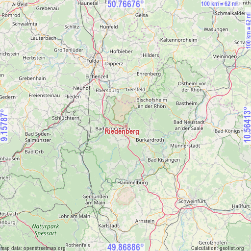
Riedenberg GPS coordinates[2]
50° 19' 11.748" North, 9° 51' 39.6" East
| Map corner | latitude | longitude |
|---|---|---|
| Upper-left | 50.76676°, | 9.15787° |
| Center: | 50.31993°, | 9.861° |
| Lower-right: | 49.86886°, | 10.56413° |
| Map W x H: | 99.8×99.8 km | = 62×62mi |
| max Lat: | 55.01917° ⇑56.2% North |
| Riedenberg: | 50.31993° |
| min Lat: | ⇓43.8% South 47.40724° |
| min Long | Riedenberg | max Long |
| 5.92978° | 9.861° | 14.98853° |
| W 48%⇐ | ⇒52% E |
Elevation
Elevation of Riedenberg is 393 m = 1289 ft, and this is 143.9 m = 472 ft above average elevation for this country.
| Max E: |
1256 m = 4121 ft | 25.6% |
| Riedenberg | 393 m 1289 ft | |
| Avg. | 249.1 m = 817 ft | |
Min E: |
-5 m = -16 ft | 74.4% |
See also: Germany elevation on elevation.city.
Geographical zone
Riedenberg is located in North temperate zone (between Tropic of Cancer and the Arctic Circle). Distance of this North polar circle is 1806.1 km =1122.3 mi to North.| Distance of | km | miles | from Riedenberg |
|---|---|---|---|
| North Pole | 4412 | 2741.5 | to North |
| Arctic Circle | 1806.1 | 1122.3 | to North |
| Tropic Cancer | 2989.1 | 1857.3 | to South |
| Equator | 5595.1 | 3476.6 | to South |


Nearby cities:
15 places around Riedenberg: (largest is in red/bold)
• Bad Bocklet
16.6 km =10.3 mi,  110°
110°
• Bad Brückenau
5.2 km =3.2 mi,  255°
255°
• Bischofsheim an der Rhön
13.9 km =8.6 mi,  48°
48°
• Burkardroth
10.7 km =6.6 mi,  120°
120°
• Geroda
5 km =3.1 mi,  150°
150°
• Gersfeld
15.1 km =9.4 mi,  14°
14°
• Kalbach
15.8 km =9.8 mi,  306°
306°
• Motten
10.5 km =6.5 mi,  323°
323°
• Oberleichtersbach
5.9 km =3.7 mi,  226°
226°
• Oberthulba
15.1 km =9.4 mi, 152°
• Sandberg
10.9 km =6.8 mi,  73°
73°
• Schondra
5.8 km =3.6 mi,  178°
178°
• Wartmannsroth
17.9 km =11.1 mi,  197°
197°
• Wildflecken
7.3 km =4.5 mi,  28°
28°
• Zeitlofs
14.9 km =9.3 mi,  244°
244°
Sources, notices
• [Note1] Compared only with cities in Germany existing in our database
• [Src1] Map data: © OpenStreetMap contributors (CC-BY-SA)
• [Src2] Other city data from geonames.org with taken over terms of usage.
• [Src3] Geographical zone / Annual Mean Temperature by Robert A. Rohde @ Wikipedia
