Poppenhausen geodata
Poppenhausen (Hesse) is a populated place; located in Germany in Europe/Berlin (GMT+2) time zone. With population of 2,685 people, there are 4248 cities with bigger population in this country. Compared to other cities in Germany, 53% of cities are located further ↑North; 51.9% of cities are located further →East and 83.1% of cities have lower elevation than Poppenhausen. Note1
Administrative division(s):
- Level 1: Hesse
- Level 2: Regierungsbezirk Kassel
- Level 3: Landkreis Fulda
- Level 4: Poppenhausen (Wasserkuppe)


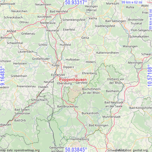
Poppenhausen GPS coordinates[2]
50° 29' 16.548" North, 9° 52' 4.62" East
| Map corner | latitude | longitude |
|---|---|---|
| Upper-left | 50.93317°, | 9.16483° |
| Center: | 50.48793°, | 9.86795° |
| Lower-right: | 50.03845°, | 10.57108° |
| Map W x H: | 99.5×99.5 km | = 61.8×61.8mi |
| max Lat: | 55.01917° ⇑53% North |
| Poppenhausen: | 50.48793° |
| min Lat: | ⇓47% South 47.40724° |
| min Long | Poppenhausen | max Long |
| 5.92978° | 9.86795° | 14.98853° |
| W 48.1%⇐ | ⇒51.9% E |
Elevation
Elevation of Poppenhausen is 454 m = 1490 ft, and this is 204.9 m = 672 ft above average elevation for this country.
| Max E: |
1256 m = 4121 ft | 16.9% |
| Poppenhausen | 454 m 1490 ft | |
| Avg. | 249.1 m = 817 ft | |
Min E: |
-5 m = -16 ft | 83.1% |
See also: Germany elevation on elevation.city.
Geographical zone
Poppenhausen is located in North temperate zone (between Tropic of Cancer and the Arctic Circle). Distance of this North polar circle is 1787.4 km =1110.6 mi to North.| Distance of | km | miles | from Poppenhausen |
|---|---|---|---|
| North Pole | 4393.3 | 2729.9 | to North |
| Arctic Circle | 1787.4 | 1110.6 | to North |
| Tropic Cancer | 3007.8 | 1869 | to South |
| Equator | 5613.7 | 3488.2 | to South |


Nearby cities:
15 places around Poppenhausen: (largest is in red/bold)
• Birx
13.8 km =8.6 mi,  68°
68°
• Bischofsheim an der Rhön
13.7 km =8.5 mi,  133°
133°
• Dipperz
8 km =5 mi,  320°
320°
• Eichenzell
12.1 km =7.5 mi,  273°
273°
• Frankenheim
15.5 km =9.6 mi, 66°
• Fulda
15.4 km =9.6 mi,  297°
297°
• Gersfeld
5.2 km =3.2 mi,  141°
141°
• Hilders
13.4 km =8.3 mi,  45°
45°
• Hofbieber
11.2 km =7 mi,  348°
348°
• Kalbach
16.1 km =10 mi,  234°
234°
• Künzell
12.3 km =7.6 mi, 300°
• Motten
12.3 km =7.6 mi,  213°
213°
• Neuhof
18.1 km =11.2 mi,  257°
257°
• Oberweid
17.9 km =11.1 mi, 50°
• Wildflecken
12.6 km =7.8 mi,  166°
166°
Sources, notices
• [Note1] Compared only with cities in Germany existing in our database
• [Src1] Map data: © OpenStreetMap contributors (CC-BY-SA)
• [Src2] Other city data from geonames.org with taken over terms of usage.
• [Src3] Geographical zone / Annual Mean Temperature by Robert A. Rohde @ Wikipedia
