Wietzendorf geodata
Wietzendorf (Lower Saxony) is a seat of a fourth-order administrative division; located in Germany in Europe/Berlin (GMT+2) time zone. With population of 4,105 people, there are 3226 cities with bigger population in this country. Compared to other cities in Germany, 81.2% of cities are located further ↓South; 50.3% of cities are located further →East and 74.7% of cities have higher elevation than Wietzendorf. Note1
Administrative division(s):
- Level 1: Lower Saxony
- Level 3: Landkreis Heidekreis
- Level 4: Wietzendorf


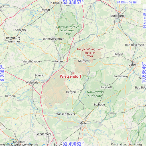
Wietzendorf GPS coordinates[2]
52° 55' 0.012" North, 9° 58' 59.988" East
| Map corner | latitude | longitude |
|---|---|---|
| Upper-left | 53.33857°, | 9.2802° |
| Center: | 52.91667°, | 9.98333° |
| Lower-right: | 52.49062°, | 10.68646° |
| Map W x H: | 94.3×94.3 km | = 58.6×58.6mi |
| max Lat: | 55.01917° ⇑18.8% North |
| Wietzendorf: | 52.91667° |
| min Lat: | ⇓81.2% South 47.40724° |
| min Long | Wietzendorf | max Long |
| 5.92978° | 9.98333° | 14.98853° |
| W 49.7%⇐ | ⇒50.3% E |
Elevation
Elevation of Wietzendorf is 64 m = 210 ft, and this is 185.1 m = 607 ft below average elevation for this country.
| Max E: |
1256 m = 4121 ft | 74.7% |
| Avg. | 249.1 m = 817 ft | |
| Wietzendorf | 64 m = 210 ft | |
Min E: |
-5 m = -16 ft | 25.3% |
See also: Germany elevation on elevation.city.
Geographical zone
Wietzendorf is located in North temperate zone (between Tropic of Cancer and the Arctic Circle). Distance of this North polar circle is 1517.4 km =942.9 mi to North.| Distance of | km | miles | from Wietzendorf |
|---|---|---|---|
| North Pole | 4123.3 | 2562.1 | to North |
| Arctic Circle | 1517.4 | 942.9 | to North |
| Tropic Cancer | 3277.9 | 2036.8 | to South |
| Equator | 5883.8 | 3656 | to South |


Nearby cities:
15 places around Wietzendorf: (largest is in red/bold)
• Bad Fallingbostel
20.1 km =12.5 mi,  253°
253°
• Bergen
12.1 km =7.5 mi,  186°
186°
• Bispingen
18.5 km =11.5 mi,  2°
2°
• Bomlitz
22.4 km =13.9 mi,  265°
265°
• Eimke
22.8 km =14.2 mi,  76°
76°
• Eschede
26.4 km =16.4 mi,  140°
140°
• Faßberg
12.4 km =7.7 mi,  98°
98°
• Hermannsburg
11.8 km =7.3 mi, 142°
• Munster
10.4 km =6.5 mi,  42°
42°
• Neuenkirchen
22.6 km =14 mi,  304°
304°
• Rehlingen
26.4 km =16.4 mi, 37°
• Schneverdingen
25.6 km =15.9 mi,  330°
330°
• Soltau
12.2 km =7.6 mi,  309°
309°
• Unterlüß
22.9 km =14.2 mi,  113°
113°
• Wriedel
24.7 km =15.3 mi,  58°
58°
Sources, notices
• [Note1] Compared only with cities in Germany existing in our database
• [Src1] Map data: © OpenStreetMap contributors (CC-BY-SA)
• [Src2] Other city data from geonames.org with taken over terms of usage.
• [Src3] Geographical zone / Annual Mean Temperature by Robert A. Rohde @ Wikipedia
