Rehlingen geodata
Rehlingen (Lower Saxony) is a seat of a fourth-order administrative division; located in Germany in Europe/Berlin (GMT+2) time zone. With population of 730 people, there are 8195 cities with bigger population in this country. Compared to other cities in Germany, 82.3% of cities are located further ↓South; 53.8% of cities are located further ←West and 78.7% of cities have higher elevation than Rehlingen. Note1


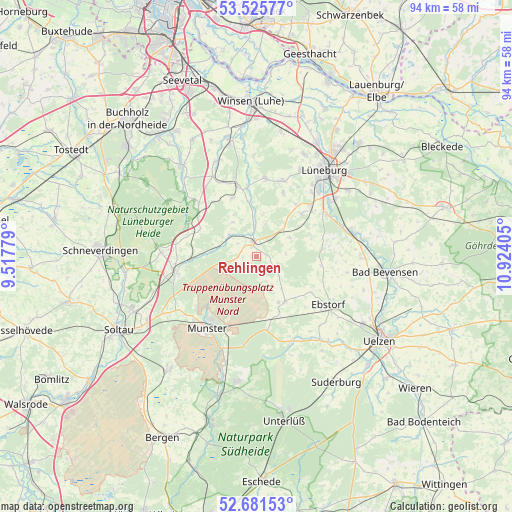
Rehlingen GPS coordinates[2]
53° 6' 20.592" North, 10° 13' 15.312" East
| Map corner | latitude | longitude |
|---|---|---|
| Upper-left | 53.52577°, | 9.51779° |
| Center: | 53.10572°, | 10.22092° |
| Lower-right: | 52.68153°, | 10.92405° |
| Map W x H: | 93.9×93.9 km | = 58.3×58.3mi |
| max Lat: | 55.01917° ⇑17.7% North |
| Rehlingen: | 53.10572° |
| min Lat: | ⇓82.3% South 47.40724° |
| min Long | Rehlingen | max Long |
| 5.92978° | 10.22092° | 14.98853° |
| W 53.8%⇐ | ⇒46.2% E |
Elevation
Elevation of Rehlingen is 51 m = 167 ft, and this is 198.1 m = 650 ft below average elevation for this country.
| Max E: |
1256 m = 4121 ft | 78.7% |
| Avg. | 249.1 m = 817 ft | |
| Rehlingen | 51 m = 167 ft | |
Min E: |
-5 m = -16 ft | 21.3% |
See also: Germany elevation on elevation.city.
Geographical zone
Rehlingen is located in North temperate zone (between Tropic of Cancer and the Arctic Circle). Distance of this North polar circle is 1496.4 km =929.8 mi to North.| Distance of | km | miles | from Rehlingen |
|---|---|---|---|
| North Pole | 4102.3 | 2549.1 | to North |
| Arctic Circle | 1496.4 | 929.8 | to North |
| Tropic Cancer | 3298.9 | 2049.8 | to South |
| Equator | 5904.8 | 3669.1 | to South |


Nearby cities:
15 places around Rehlingen: (largest is in red/bold)
• Amelinghausen
2.1 km =1.3 mi,  344°
344°
• Barnstedt
10.2 km =6.3 mi,  72°
72°
• Betzendorf
7.1 km =4.4 mi,  60°
60°
• Egestorf
14.3 km =8.9 mi,  312°
312°
• Embsen
11.4 km =7.1 mi,  46°
46°
• Eyendorf
11.5 km =7.1 mi, 335°
• Hanstedt Eins
12.2 km =7.6 mi,  122°
122°
• Kirchgellersen
15.1 km =9.4 mi,  20°
20°
• Melbeck
14.7 km =9.1 mi, 54°
• Oldendorf
5.6 km =3.5 mi,  355°
355°
• Salzhausen
13.5 km =8.4 mi,  345°
345°
• Soderstorf
6.4 km =4 mi, 310°
• Südergellersen
13.4 km =8.3 mi, 23°
• Westergellersen
14.3 km =8.9 mi,  7°
7°
• Wriedel
9.8 km =6.1 mi,  147°
147°
Sources, notices
• [Note1] Compared only with cities in Germany existing in our database
• [Src1] Map data: © OpenStreetMap contributors (CC-BY-SA)
• [Src2] Other city data from geonames.org with taken over terms of usage.
• [Src3] Geographical zone / Annual Mean Temperature by Robert A. Rohde @ Wikipedia
