Wettelrode geodata
Wettelrode (Saxony-Anhalt) is a populated place; located in Germany in Europe/Berlin (GMT+2) time zone. With population of 620 people, there are 8720 cities with bigger population in this country. Compared to other cities in Germany, 66.5% of cities are located further ↓South; 71.1% of cities are located further ←West and 59.8% of cities have lower elevation than Wettelrode. Note1


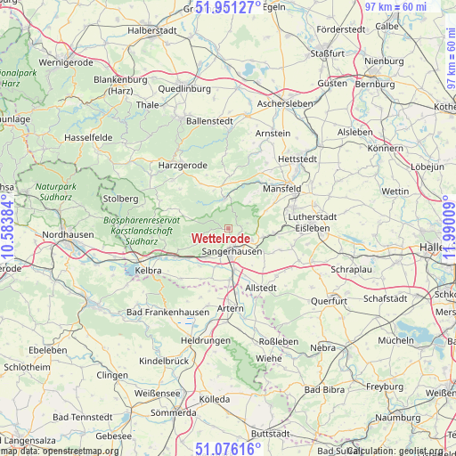
Wettelrode GPS coordinates[2]
51° 30' 56.952" North, 11° 17' 13.056" East
| Map corner | latitude | longitude |
|---|---|---|
| Upper-left | 51.95127°, | 10.58384° |
| Center: | 51.51582°, | 11.28696° |
| Lower-right: | 51.07616°, | 11.99009° |
| Map W x H: | 97.3×97.3 km | = 60.5×60.5mi |
| max Lat: | 55.01917° ⇑33.5% North |
| Wettelrode: | 51.51582° |
| min Lat: | ⇓66.5% South 47.40724° |
| min Long | Wettelrode | max Long |
| 5.92978° | 11.28696° | 14.98853° |
| W 71.1%⇐ | ⇒28.9% E |
Elevation
Elevation of Wettelrode is 289 m = 948 ft, and this is 39.9 m = 131 ft above average elevation for this country.
| Max E: |
1256 m = 4121 ft | 40.2% |
| Wettelrode | 289 m 948 ft | |
| Avg. | 249.1 m = 817 ft | |
Min E: |
-5 m = -16 ft | 59.8% |
See also: Germany elevation on elevation.city.
Geographical zone
Wettelrode is located in North temperate zone (between Tropic of Cancer and the Arctic Circle). Distance of this North polar circle is 1673.2 km =1039.7 mi to North.| Distance of | km | miles | from Wettelrode |
|---|---|---|---|
| North Pole | 4279 | 2658.8 | to North |
| Arctic Circle | 1673.2 | 1039.7 | to North |
| Tropic Cancer | 3122.1 | 1940 | to South |
| Equator | 5728 | 3559.2 | to South |


Nearby cities:
15 places around Wettelrode: (largest is in red/bold)
• Annarode
8.9 km =5.5 mi,  64°
64°
• Beyernaumburg
8.8 km =5.5 mi,  122°
122°
• Blankenheim
9.9 km =6.2 mi,  95°
95°
• Braunschwende
8.8 km =5.5 mi,  339°
339°
• Brücken
10.1 km =6.3 mi,  217°
217°
• Edersleben
11 km =6.8 mi,  181°
181°
• Emseloh
7.4 km =4.6 mi, 102°
• Gonna
2.6 km =1.6 mi,  105°
105°
• Oberröblingen
8.9 km =5.5 mi,  170°
170°
• Obersdorf
2.7 km =1.7 mi,  77°
77°
• Riestedt
5.6 km =3.5 mi, 114°
• Riethnordhausen
11.1 km =6.9 mi,  198°
198°
• Sangerhausen
4.9 km =3 mi, 173°
• Wallhausen
8.2 km =5.1 mi, 222°
• Wippra
6.4 km =4 mi,  352°
352°
Sources, notices
• [Note1] Compared only with cities in Germany existing in our database
• [Src1] Map data: © OpenStreetMap contributors (CC-BY-SA)
• [Src2] Other city data from geonames.org with taken over terms of usage.
• [Src3] Geographical zone / Annual Mean Temperature by Robert A. Rohde @ Wikipedia
