Oberröblingen geodata
Oberröblingen (Saxony-Anhalt) is a populated place; located in Germany in Europe/Berlin (GMT+2) time zone. With population of 1,701 people, there are 5511 cities with bigger population in this country. Compared to other cities in Germany, 65.4% of cities are located further ↓South; 71.4% of cities are located further ←West and 63.3% of cities have higher elevation than Oberröblingen. Note1


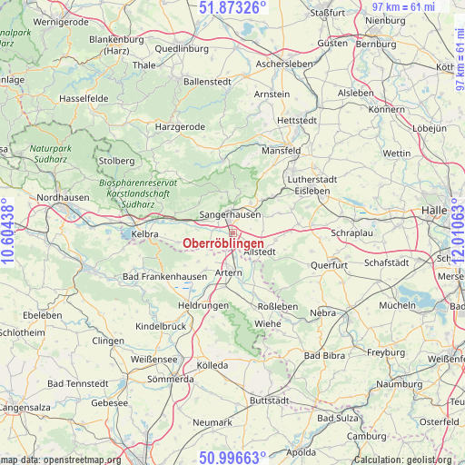
Oberröblingen GPS coordinates[2]
51° 26' 13.38" North, 11° 18' 27" East
| Map corner | latitude | longitude |
|---|---|---|
| Upper-left | 51.87326°, | 10.60438° |
| Center: | 51.43705°, | 11.3075° |
| Lower-right: | 50.99663°, | 12.01063° |
| Map W x H: | 97.5×97.5 km | = 60.6×60.6mi |
| max Lat: | 55.01917° ⇑34.6% North |
| Oberröblingen: | 51.43705° |
| min Lat: | ⇓65.4% South 47.40724° |
| min Long | Oberröblingen | max Long |
| 5.92978° | 11.3075° | 14.98853° |
| W 71.4%⇐ | ⇒28.6% E |
Elevation
Elevation of Oberröblingen is 130 m = 427 ft, and this is 119.1 m = 391 ft below average elevation for this country.
| Max E: |
1256 m = 4121 ft | 63.3% |
| Avg. | 249.1 m = 817 ft | |
| Oberröblingen | 130 m = 427 ft | |
Min E: |
-5 m = -16 ft | 36.7% |
See also: Germany elevation on elevation.city.
Geographical zone
Oberröblingen is located in North temperate zone (between Tropic of Cancer and the Arctic Circle). Distance of this North polar circle is 1681.9 km =1045.1 mi to North.| Distance of | km | miles | from Oberröblingen |
|---|---|---|---|
| North Pole | 4287.8 | 2664.3 | to North |
| Arctic Circle | 1681.9 | 1045.1 | to North |
| Tropic Cancer | 3113.3 | 1934.5 | to South |
| Equator | 5719.3 | 3553.8 | to South |


Nearby cities:
15 places around Oberröblingen: (largest is in red/bold)
• Allstedt
6.6 km =4.1 mi,  123°
123°
• Artern
8.2 km =5.1 mi,  187°
187°
• Beyernaumburg
7.3 km =4.5 mi,  55°
55°
• Borxleben
6.6 km =4.1 mi,  231°
231°
• Brücken
7.6 km =4.7 mi,  275°
275°
• Edersleben
2.8 km =1.7 mi,  216°
216°
• Gonna
8.1 km =5 mi,  7°
7°
• Mönchpfiffel-Nikolausrieth
7.2 km =4.5 mi,  145°
145°
• Riestedt
7.4 km =4.6 mi,  29°
29°
• Riethnordhausen
5.2 km =3.2 mi,  250°
250°
• Sangerhausen
4 km =2.5 mi,  347°
347°
• Voigtstedt
5 km =3.1 mi,  178°
178°
• Wallhausen
7.4 km =4.6 mi,  291°
291°
• Wettelrode
8.9 km =5.5 mi, 350°
• Wolferstedt
8.9 km =5.5 mi,  98°
98°
Sources, notices
• [Note1] Compared only with cities in Germany existing in our database
• [Src1] Map data: © OpenStreetMap contributors (CC-BY-SA)
• [Src2] Other city data from geonames.org with taken over terms of usage.
• [Src3] Geographical zone / Annual Mean Temperature by Robert A. Rohde @ Wikipedia
