Unter-Abtsteinach geodata
Unter-Abtsteinach (Hesse) is a populated place; located in Germany in Europe/Berlin (GMT+2) time zone. With population of 2,414 people, there are 4543 cities with bigger population in this country. Compared to other cities in Germany, 75.2% of cities are located further ↑North; 68.1% of cities are located further →East and 75.8% of cities have lower elevation than Unter-Abtsteinach. Note1
Administrative division(s):
- Level 1: Hesse
- Level 2: Regierungsbezirk Darmstadt
- Level 3: Landkreis Bergstraße
- Level 4: Abtsteinach


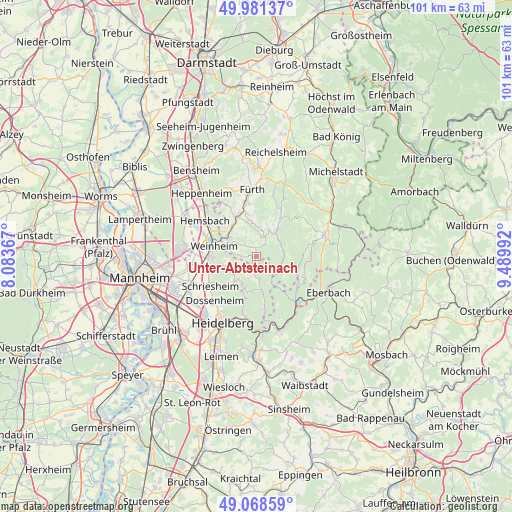
Unter-Abtsteinach GPS coordinates[2]
49° 31' 37.596" North, 8° 47' 12.444" East
| Map corner | latitude | longitude |
|---|---|---|
| Upper-left | 49.98137°, | 8.08367° |
| Center: | 49.52711°, | 8.78679° |
| Lower-right: | 49.06859°, | 9.48992° |
| Map W x H: | 101.5×101.5 km | = 63.1×63.1mi |
| max Lat: | 55.01917° ⇑75.2% North |
| Unter-Abtsteinach: | 49.52711° |
| min Lat: | ⇓24.8% South 47.40724° |
| min Long | Unter-Abtsteina | max Long |
| 5.92978° | 8.78679° | 14.98853° |
| W 31.9%⇐ | ⇒68.1% E |
Elevation
Elevation of Unter-Abtsteinach is 404 m = 1325 ft, and this is 154.9 m = 508 ft above average elevation for this country.
| Max E: |
1256 m = 4121 ft | 24.2% |
| Unter-Abtsteinach | 404 m 1325 ft | |
| Avg. | 249.1 m = 817 ft | |
Min E: |
-5 m = -16 ft | 75.8% |
See also: Germany elevation on elevation.city.
Geographical zone
Unter-Abtsteinach is located in North temperate zone (between Tropic of Cancer and the Arctic Circle). Distance of this North polar circle is 1894.3 km =1177.1 mi to North.| Distance of | km | miles | from Unter-Abtsteinach |
|---|---|---|---|
| North Pole | 4500.2 | 2796.3 | to North |
| Arctic Circle | 1894.3 | 1177.1 | to North |
| Tropic Cancer | 2901 | 1802.6 | to South |
| Equator | 5506.9 | 3421.8 | to South |


Nearby cities:
15 places around Unter-Abtsteinach: (largest is in red/bold)
• Birkenau
7 km =4.3 mi,  304°
304°
• Dossenheim
11.8 km =7.3 mi,  223°
223°
• Heddesbach
6 km =3.7 mi,  150°
150°
• Heiligkreuzsteinach
4.9 km =3 mi,  173°
173°
• Hemsbach
12.3 km =7.6 mi,  305°
305°
• Hirschberg an der Bergstraße
9.6 km =6 mi,  256°
256°
• Hirschhorn
12 km =7.5 mi,  138°
138°
• Mörlenbach
8.8 km =5.5 mi,  334°
334°
• Rimbach
11 km =6.8 mi,  351°
351°
• Rothenberg
10 km =6.2 mi,  108°
108°
• Schriesheim
10.7 km =6.6 mi,  236°
236°
• Schönau
10.2 km =6.3 mi, 171°
• Wald-Michelbach
5.8 km =3.6 mi,  34°
34°
• Weinheim
9 km =5.6 mi,  285°
285°
• Wilhelmsfeld
6.7 km =4.2 mi,  200°
200°
Sources, notices
• [Note1] Compared only with cities in Germany existing in our database
• [Src1] Map data: © OpenStreetMap contributors (CC-BY-SA)
• [Src2] Other city data from geonames.org with taken over terms of usage.
• [Src3] Geographical zone / Annual Mean Temperature by Robert A. Rohde @ Wikipedia
