Tarbek geodata
Tarbek (Schleswig-Holstein) is a seat of a fourth-order administrative division; located in Germany in Europe/Berlin (GMT+2) time zone. With population of 173 people, there are 10578 cities with bigger population in this country. Compared to other cities in Germany, 93.3% of cities are located further ↓South; 54.6% of cities are located further ←West and 78.3% of cities have higher elevation than Tarbek. Note1


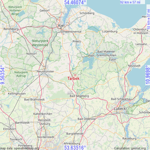
Tarbek GPS coordinates[2]
54° 3' 0" North, 10° 16' 0.012" East
| Map corner | latitude | longitude |
|---|---|---|
| Upper-left | 54.46074°, | 9.56354° |
| Center: | 54.05°, | 10.26667° |
| Lower-right: | 53.63516°, | 10.9698° |
| Map W x H: | 91.8×91.8 km | = 57×57mi |
| max Lat: | 55.01917° ⇑6.7% North |
| Tarbek: | 54.05° |
| min Lat: | ⇓93.3% South 47.40724° |
| min Long | Tarbek | max Long |
| 5.92978° | 10.26667° | 14.98853° |
| W 54.6%⇐ | ⇒45.4% E |
Elevation
Elevation of Tarbek is 52 m = 171 ft, and this is 197.1 m = 647 ft below average elevation for this country.
| Max E: |
1256 m = 4121 ft | 78.3% |
| Avg. | 249.1 m = 817 ft | |
| Tarbek | 52 m = 171 ft | |
Min E: |
-5 m = -16 ft | 21.7% |
See also: Germany elevation on elevation.city.
Geographical zone
Tarbek is located in North temperate zone (between Tropic of Cancer and the Arctic Circle). Distance of this North polar circle is 1391.4 km =864.6 mi to North.| Distance of | km | miles | from Tarbek |
|---|---|---|---|
| North Pole | 3997.3 | 2483.8 | to North |
| Arctic Circle | 1391.4 | 864.6 | to North |
| Tropic Cancer | 3403.9 | 2115.1 | to South |
| Equator | 6009.8 | 3734.3 | to South |


Nearby cities:
15 places around Tarbek: (largest is in red/bold)
• Belau
5.4 km =3.4 mi,  354°
354°
• Blunk
5.5 km =3.4 mi,  145°
145°
• Bornhöved
2.9 km =1.8 mi,  310°
310°
• Daldorf
3.9 km =2.4 mi,  196°
196°
• Damsdorf
3.8 km =2.4 mi,  60°
60°
• Gönnebek
4.6 km =2.9 mi,  268°
268°
• Kalübbe
7.5 km =4.7 mi,  8°
8°
• Negernbötel
7.5 km =4.7 mi,  188°
188°
• Nehms
7.5 km =4.7 mi,  119°
119°
• Rendswühren
6.6 km =4.1 mi,  304°
304°
• Ruhwinkel
6.4 km =4 mi,  329°
329°
• Schmalensee
3.7 km =2.3 mi,  3°
3°
• Stocksee
6.6 km =4.1 mi,  47°
47°
• Tensfeld
3.5 km =2.2 mi,  104°
104°
• Trappenkamp
3.6 km =2.2 mi,  251°
251°
Sources, notices
• [Note1] Compared only with cities in Germany existing in our database
• [Src1] Map data: © OpenStreetMap contributors (CC-BY-SA)
• [Src2] Other city data from geonames.org with taken over terms of usage.
• [Src3] Geographical zone / Annual Mean Temperature by Robert A. Rohde @ Wikipedia
