Tagmersheim geodata
Tagmersheim (Bavaria) is a seat of a fourth-order administrative division; located in Germany in Europe/Berlin (GMT+2) time zone. With population of 1,083 people, there are 6897 cities with bigger population in this country. Compared to other cities in Germany, 85.2% of cities are located further ↑North; 66.4% of cities are located further ←West and 88.5% of cities have lower elevation than Tagmersheim. Note1
Administrative division(s):
- Level 1: Bavaria
- Level 2: Swabia
- Level 3: Landkreis Donau-Ries
- Level 4: Tagmersheim


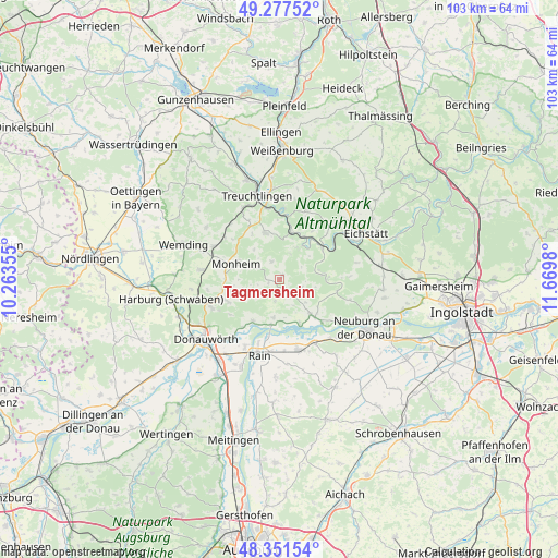
Tagmersheim GPS coordinates[2]
48° 49' 0.012" North, 10° 58' 0.012" East
| Map corner | latitude | longitude |
|---|---|---|
| Upper-left | 49.27752°, | 10.26355° |
| Center: | 48.81667°, | 10.96667° |
| Lower-right: | 48.35154°, | 11.6698° |
| Map W x H: | 103×103 km | = 64×64mi |
| max Lat: | 55.01917° ⇑85.2% North |
| Tagmersheim: | 48.81667° |
| min Lat: | ⇓14.8% South 47.40724° |
| min Long | Tagmersheim | max Long |
| 5.92978° | 10.96667° | 14.98853° |
| W 66.4%⇐ | ⇒33.6% E |
Elevation
Elevation of Tagmersheim is 499 m = 1637 ft, and this is 249.9 m = 820 ft above average elevation for this country.
| Max E: |
1256 m = 4121 ft | 11.5% |
| Tagmersheim | 499 m 1637 ft | |
| Avg. | 249.1 m = 817 ft | |
Min E: |
-5 m = -16 ft | 88.5% |
See also: Germany elevation on elevation.city.
Geographical zone
Tagmersheim is located in North temperate zone (between Tropic of Cancer and the Arctic Circle). Distance of this North polar circle is 1973.3 km =1226.2 mi to North.| Distance of | km | miles | from Tagmersheim |
|---|---|---|---|
| North Pole | 4579.2 | 2845.4 | to North |
| Arctic Circle | 1973.3 | 1226.2 | to North |
| Tropic Cancer | 2822 | 1753.5 | to South |
| Equator | 5427.9 | 3372.7 | to South |


Nearby cities:
15 places around Tagmersheim: (largest is in red/bold)
• Buchdorf
10.4 km =6.5 mi,  249°
249°
• Burgheim
13.4 km =8.3 mi,  164°
164°
• Daiting
5.3 km =3.3 mi,  238°
238°
• Genderkingen
14.3 km =8.9 mi,  205°
205°
• Kaisheim
13.6 km =8.5 mi, 246°
• Langenaltheim
8.9 km =5.5 mi,  342°
342°
• Marxheim
8.5 km =5.3 mi,  190°
190°
• Monheim
8.5 km =5.3 mi,  290°
290°
• Niederschönenfeld
11.4 km =7.1 mi, 192°
• Otting
13.7 km =8.5 mi,  297°
297°
• Pappenheim
13 km =8.1 mi,  2°
2°
• Rennertshofen
8.6 km =5.3 mi,  137°
137°
• Rögling
3.9 km =2.4 mi, 341°
• Schernfeld
13.5 km =8.4 mi,  46°
46°
• Solnhofen
9.1 km =5.7 mi,  13°
13°
Sources, notices
• [Note1] Compared only with cities in Germany existing in our database
• [Src1] Map data: © OpenStreetMap contributors (CC-BY-SA)
• [Src2] Other city data from geonames.org with taken over terms of usage.
• [Src3] Geographical zone / Annual Mean Temperature by Robert A. Rohde @ Wikipedia
