Pappenheim geodata
Pappenheim (Bavaria) is a populated place; located in Germany in Europe/Berlin (GMT+2) time zone. With population of 4,476 people, there are 3048 cities with bigger population in this country. Compared to other cities in Germany, 83.7% of cities are located further ↑North; 66.7% of cities are located further ←West and 77% of cities have lower elevation than Pappenheim. Note1
Administrative division(s):
- Level 1: Bavaria
- Level 2: Regierungsbezirk Mittelfranken
- Level 3: Landkreis Weißenburg-Gunzenhausen
- Level 4: Pappenheim


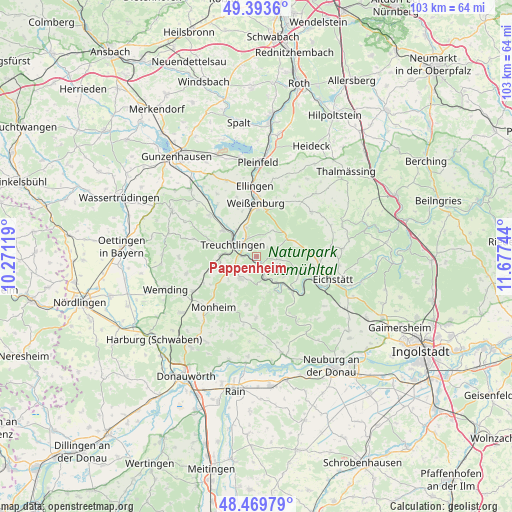
Pappenheim GPS coordinates[2]
48° 56' 1.788" North, 10° 58' 27.516" East
| Map corner | latitude | longitude |
|---|---|---|
| Upper-left | 49.3936°, | 10.27119° |
| Center: | 48.93383°, | 10.97431° |
| Lower-right: | 48.46979°, | 11.67744° |
| Map W x H: | 102.7×102.7 km | = 63.8×63.8mi |
| max Lat: | 55.01917° ⇑83.7% North |
| Pappenheim: | 48.93383° |
| min Lat: | ⇓16.3% South 47.40724° |
| min Long | Pappenheim | max Long |
| 5.92978° | 10.97431° | 14.98853° |
| W 66.7%⇐ | ⇒33.3% E |
Elevation
Elevation of Pappenheim is 412 m = 1352 ft, and this is 162.9 m = 534 ft above average elevation for this country.
| Max E: |
1256 m = 4121 ft | 23% |
| Pappenheim | 412 m 1352 ft | |
| Avg. | 249.1 m = 817 ft | |
Min E: |
-5 m = -16 ft | 77% |
See also: Germany elevation on elevation.city.
Geographical zone
Pappenheim is located in North temperate zone (between Tropic of Cancer and the Arctic Circle). Distance of this North polar circle is 1960.2 km =1218 mi to North.| Distance of | km | miles | from Pappenheim |
|---|---|---|---|
| North Pole | 4566.1 | 2837.2 | to North |
| Arctic Circle | 1960.2 | 1218 | to North |
| Tropic Cancer | 2835 | 1761.6 | to South |
| Equator | 5440.9 | 3380.8 | to South |


Nearby cities:
15 places around Pappenheim: (largest is in red/bold)
• Burgsalach
14.2 km =8.8 mi,  39°
39°
• Ellingen
14.1 km =8.8 mi,  358°
358°
• Höttingen
14.5 km =9 mi,  8°
8°
• Langenaltheim
5.5 km =3.4 mi,  214°
214°
• Markt Berolzheim
12.7 km =7.9 mi,  311°
311°
• Monheim
13.1 km =8.1 mi,  220°
220°
• Otting
14.4 km =8.9 mi,  241°
241°
• Raitenbuch
14.2 km =8.8 mi,  50°
50°
• Rögling
9.5 km =5.9 mi,  190°
190°
• Schernfeld
9.9 km =6.2 mi,  112°
112°
• Solnhofen
4.5 km =2.8 mi,  159°
159°
• Tagmersheim
13 km =8.1 mi,  182°
182°
• Treuchtlingen
5.3 km =3.3 mi,  295°
295°
• Weißenburg in Bayern
10.8 km =6.7 mi, 359°
• Wolferstadt
14.5 km =9 mi,  256°
256°
Sources, notices
• [Note1] Compared only with cities in Germany existing in our database
• [Src1] Map data: © OpenStreetMap contributors (CC-BY-SA)
• [Src2] Other city data from geonames.org with taken over terms of usage.
• [Src3] Geographical zone / Annual Mean Temperature by Robert A. Rohde @ Wikipedia
