Sulzthal geodata
Sulzthal (Bavaria) is a populated place; located in Germany in Europe/Berlin (GMT+2) time zone. With population of 944 people, there are 7368 cities with bigger population in this country. Compared to other cities in Germany, 60.7% of cities are located further ↑North; 50.7% of cities are located further ←West and 54.3% of cities have lower elevation than Sulzthal. Note1
Administrative division(s):
- Level 1: Bavaria
- Level 2: Regierungsbezirk Unterfranken
- Level 3: Landkreis Bad Kissingen
- Level 4: Sulzthal, Markt


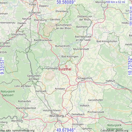
Sulzthal GPS coordinates[2]
50° 7' 56.28" North, 10° 2' 4.884" East
| Map corner | latitude | longitude |
|---|---|---|
| Upper-left | 50.58089°, | 9.33157° |
| Center: | 50.1323°, | 10.03469° |
| Lower-right: | 49.67946°, | 10.73782° |
| Map W x H: | 100.2×100.2 km | = 62.3×62.3mi |
| max Lat: | 55.01917° ⇑60.7% North |
| Sulzthal: | 50.1323° |
| min Lat: | ⇓39.3% South 47.40724° |
| min Long | Sulzthal | max Long |
| 5.92978° | 10.03469° | 14.98853° |
| W 50.7%⇐ | ⇒49.3% E |
Elevation
Elevation of Sulzthal is 254 m = 833 ft, and this is 4.9 m = 16 ft above average elevation for this country.
| Max E: |
1256 m = 4121 ft | 45.7% |
| Sulzthal | 254 m 833 ft | |
| Avg. | 249.1 m = 817 ft | |
Min E: |
-5 m = -16 ft | 54.3% |
See also: Germany elevation on elevation.city.
Geographical zone
Sulzthal is located in North temperate zone (between Tropic of Cancer and the Arctic Circle). Distance of this North polar circle is 1827 km =1135.2 mi to North.| Distance of | km | miles | from Sulzthal |
|---|---|---|---|
| North Pole | 4432.9 | 2754.5 | to North |
| Arctic Circle | 1827 | 1135.2 | to North |
| Tropic Cancer | 2968.3 | 1844.4 | to South |
| Equator | 5574.2 | 3463.6 | to South |


Nearby cities:
15 places around Sulzthal: (largest is in red/bold)
• Aura an der Saale
4 km =2.5 mi,  330°
330°
• Bad Kissingen
8.4 km =5.2 mi,  21°
21°
• Elfershausen
5.5 km =3.4 mi,  287°
287°
• Euerbach
10.7 km =6.6 mi,  136°
136°
• Euerdorf
2 km =1.2 mi,  335°
335°
• Fuchsstadt
7.7 km =4.8 mi,  249°
249°
• Hammelburg
10.4 km =6.5 mi,  260°
260°
• Niederwerrn
13.2 km =8.2 mi,  126°
126°
• Nüdlingen
11.7 km =7.3 mi,  32°
32°
• Oberthulba
9.2 km =5.7 mi,  323°
323°
• Oerlenbach
7.3 km =4.5 mi,  74°
74°
• Poppenhausen
8.5 km =5.3 mi,  115°
115°
• Ramsthal
2.5 km =1.6 mi, 69°
• Rannungen
12.7 km =7.9 mi, 73°
• Wasserlosen
4.2 km =2.6 mi,  184°
184°
Sources, notices
• [Note1] Compared only with cities in Germany existing in our database
• [Src1] Map data: © OpenStreetMap contributors (CC-BY-SA)
• [Src2] Other city data from geonames.org with taken over terms of usage.
• [Src3] Geographical zone / Annual Mean Temperature by Robert A. Rohde @ Wikipedia
