Westendorf geodata
Westendorf (Bavaria) is a seat of a fourth-order administrative division; located in Germany in Europe/Berlin (GMT+2) time zone. With population of 1,825 people, there are 5305 cities with bigger population in this country. Compared to other cities in Germany, 96.3% of cities are located further ↑North; 62.7% of cities are located further ←West and 97.4% of cities have lower elevation than Westendorf. Note1
Administrative division(s):
- Level 1: Bavaria
- Level 2: Swabia
- Level 3: Landkreis Ostallgäu
- Level 4: Westendorf


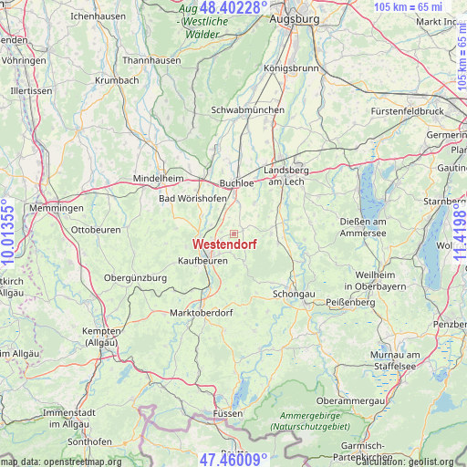
Westendorf GPS coordinates[2]
47° 55' 59.988" North, 10° 43' 0.012" East
| Map corner | latitude | longitude |
|---|---|---|
| Upper-left | 48.40228°, | 10.01355° |
| Center: | 47.93333°, | 10.71667° |
| Lower-right: | 47.46009°, | 11.4198° |
| Map W x H: | 104.8×104.8 km | = 65.1×65.1mi |
| max Lat: | 55.01917° ⇑96.3% North |
| Westendorf: | 47.93333° |
| min Lat: | ⇓3.7% South 47.40724° |
| min Long | Westendorf | max Long |
| 5.92978° | 10.71667° | 14.98853° |
| W 62.7%⇐ | ⇒37.3% E |
Elevation
Elevation of Westendorf is 679 m = 2228 ft, and this is 429.9 m = 1410 ft above average elevation for this country.
| Max E: |
1256 m = 4121 ft | 2.6% |
| Westendorf | 679 m 2228 ft | |
| Avg. | 249.1 m = 817 ft | |
Min E: |
-5 m = -16 ft | 97.4% |
See also: Germany elevation on elevation.city.
Geographical zone
Westendorf is located in North temperate zone (between Tropic of Cancer and the Arctic Circle). Distance of this North polar circle is 2071.5 km =1287.2 mi to North.| Distance of | km | miles | from Westendorf |
|---|---|---|---|
| North Pole | 4677.4 | 2906.4 | to North |
| Arctic Circle | 2071.5 | 1287.2 | to North |
| Tropic Cancer | 2723.8 | 1692.5 | to South |
| Equator | 5329.7 | 3311.7 | to South |


Nearby cities:
15 places around Westendorf: (largest is in red/bold)
• Bad Wörishofen
12.1 km =7.5 mi,  312°
312°
• Bidingen
11.5 km =7.1 mi,  176°
176°
• Buchloe
11.6 km =7.2 mi,  3°
3°
• Denklingen
10.1 km =6.3 mi,  100°
100°
• Irsee
11.2 km =7 mi,  255°
255°
• Jengen
7.4 km =4.6 mi,  5°
5°
• Kaufbeuren
9.1 km =5.7 mi,  231°
231°
• Mauerstetten
5.6 km =3.5 mi,  217°
217°
• Oberostendorf
2.3 km =1.4 mi,  59°
59°
• Osterzell
6.1 km =3.8 mi,  155°
155°
• Pforzen
7.7 km =4.8 mi,  267°
267°
• Rieden
5.3 km =3.3 mi,  290°
290°
• Stöttwang
5.6 km =3.5 mi, 180°
• Unterdießen
10.3 km =6.4 mi, 57°
• Waal
8.4 km =5.2 mi,  32°
32°
Sources, notices
• [Note1] Compared only with cities in Germany existing in our database
• [Src1] Map data: © OpenStreetMap contributors (CC-BY-SA)
• [Src2] Other city data from geonames.org with taken over terms of usage.
• [Src3] Geographical zone / Annual Mean Temperature by Robert A. Rohde @ Wikipedia
