Rieden geodata
Rieden (Bavaria) is a seat of a fourth-order administrative division; located in Germany in Europe/Berlin (GMT+2) time zone. With population of 1,222 people, there are 6506 cities with bigger population in this country. Compared to other cities in Germany, 96.1% of cities are located further ↑North; 61.6% of cities are located further ←West and 96.9% of cities have lower elevation than Rieden. Note1
Administrative division(s):
- Level 1: Bavaria
- Level 2: Swabia
- Level 3: Landkreis Ostallgäu
- Level 4: Rieden


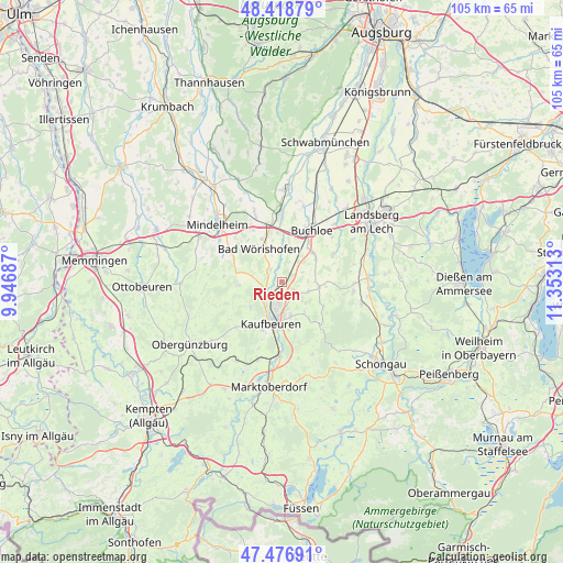
Rieden GPS coordinates[2]
47° 57' 0" North, 10° 39' 0" East
| Map corner | latitude | longitude |
|---|---|---|
| Upper-left | 48.41879°, | 9.94687° |
| Center: | 47.95°, | 10.65° |
| Lower-right: | 47.47691°, | 11.35313° |
| Map W x H: | 104.7×104.7 km | = 65.1×65.1mi |
| max Lat: | 55.01917° ⇑96.1% North |
| Rieden: | 47.95° |
| min Lat: | ⇓3.9% South 47.40724° |
| min Long | Rieden | max Long |
| 5.92978° | 10.65° | 14.98853° |
| W 61.6%⇐ | ⇒38.4% E |
Elevation
Elevation of Rieden is 659 m = 2162 ft, and this is 409.9 m = 1345 ft above average elevation for this country.
| Max E: |
1256 m = 4121 ft | 3.1% |
| Rieden | 659 m 2162 ft | |
| Avg. | 249.1 m = 817 ft | |
Min E: |
-5 m = -16 ft | 96.9% |
See also: Germany elevation on elevation.city.
Geographical zone
Rieden is located in North temperate zone (between Tropic of Cancer and the Arctic Circle). Distance of this North polar circle is 2069.6 km =1286 mi to North.| Distance of | km | miles | from Rieden |
|---|---|---|---|
| North Pole | 4675.5 | 2905.2 | to North |
| Arctic Circle | 2069.6 | 1286 | to North |
| Tropic Cancer | 2725.6 | 1693.6 | to South |
| Equator | 5331.5 | 3312.8 | to South |


Nearby cities:
15 places around Rieden: (largest is in red/bold)
• Bad Wörishofen
7.5 km =4.7 mi,  327°
327°
• Baisweil
8.2 km =5.1 mi,  265°
265°
• Buchloe
11.2 km =7 mi,  30°
30°
• Eggenthal
10.6 km =6.6 mi,  249°
249°
• Irsee
7.5 km =4.7 mi,  231°
231°
• Jengen
7.9 km =4.9 mi,  45°
45°
• Kaufbeuren
7.8 km =4.8 mi,  195°
195°
• Mauerstetten
6.5 km =4 mi,  165°
165°
• Oberostendorf
6.9 km =4.3 mi,  95°
95°
• Osterzell
10.5 km =6.5 mi,  134°
134°
• Pforzen
3.5 km =2.2 mi, 230°
• Stöttwang
8.9 km =5.5 mi,  146°
146°
• Waal
10.8 km =6.7 mi,  61°
61°
• Westendorf
5.3 km =3.3 mi,  110°
110°
• Wiedergeltingen
10.1 km =6.3 mi,  10°
10°
Sources, notices
• [Note1] Compared only with cities in Germany existing in our database
• [Src1] Map data: © OpenStreetMap contributors (CC-BY-SA)
• [Src2] Other city data from geonames.org with taken over terms of usage.
• [Src3] Geographical zone / Annual Mean Temperature by Robert A. Rohde @ Wikipedia
