Steinfurt geodata
Steinfurt (North Rhine-Westphalia) is a seat of a third-order administrative division; located in Germany in Europe/Berlin (GMT+2) time zone. With population of 34,601 people, there are 387 cities with bigger population in this country. Compared to other cities in Germany, 73.6% of cities are located further ↓South; 89.4% of cities are located further →East and 76.1% of cities have higher elevation than Steinfurt. Note1
Administrative division(s):
- Level 1: North Rhine-Westphalia
- Level 2: Regierungsbezirk Münster
- Level 3: Kreis Steinfurt
- Level 4: Steinfurt


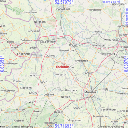
Steinfurt GPS coordinates[2]
52° 9' 1.62" North, 7° 20' 11.904" East
| Map corner | latitude | longitude |
|---|---|---|
| Upper-left | 52.57979°, | 6.63351° |
| Center: | 52.15045°, | 7.33664° |
| Lower-right: | 51.71693°, | 8.03976° |
| Map W x H: | 95.9×95.9 km | = 59.6×59.6mi |
| max Lat: | 55.01917° ⇑26.4% North |
| Steinfurt: | 52.15045° |
| min Lat: | ⇓73.6% South 47.40724° |
| min Long | Steinfurt | max Long |
| 5.92978° | 7.33664° | 14.98853° |
| W 10.6%⇐ | ⇒89.4% E |
Elevation
Elevation of Steinfurt is 59 m = 194 ft, and this is 190.1 m = 624 ft below average elevation for this country.
| Max E: |
1256 m = 4121 ft | 76.1% |
| Avg. | 249.1 m = 817 ft | |
| Steinfurt | 59 m = 194 ft | |
Min E: |
-5 m = -16 ft | 23.9% |
See also: Germany elevation on elevation.city.
Geographical zone
Steinfurt is located in North temperate zone (between Tropic of Cancer and the Arctic Circle). Distance of this North polar circle is 1602.6 km =995.8 mi to North.| Distance of | km | miles | from Steinfurt |
|---|---|---|---|
| North Pole | 4208.5 | 2615 | to North |
| Arctic Circle | 1602.6 | 995.8 | to North |
| Tropic Cancer | 3192.7 | 1983.9 | to South |
| Equator | 5798.6 | 3603.1 | to South |


Nearby cities:
15 places around Steinfurt: (largest is in red/bold)
• Altenberge
14.3 km =8.9 mi,  141°
141°
• Emsdetten
13.3 km =8.3 mi,  78°
78°
• Heek
16.6 km =10.3 mi,  256°
256°
• Horstmar
8 km =5 mi,  195°
195°
• Laer
10.6 km =6.6 mi,  172°
172°
• Metelen
8.5 km =5.3 mi,  265°
265°
• Neuenkirchen
10.8 km =6.7 mi,  12°
12°
• Nordwalde
12.5 km =7.8 mi,  126°
126°
• Ochtrup
11.9 km =7.4 mi,  302°
302°
• Ohne
13.4 km =8.3 mi,  344°
344°
• Rheine
16.6 km =10.3 mi,  25°
25°
• Samern
17.1 km =10.6 mi, 343°
• Schöppingen
9 km =5.6 mi,  231°
231°
• Suddendorf
18.4 km =11.4 mi, 335°
• Wettringen
6.7 km =4.2 mi,  349°
349°
Sources, notices
• [Note1] Compared only with cities in Germany existing in our database
• [Src1] Map data: © OpenStreetMap contributors (CC-BY-SA)
• [Src2] Other city data from geonames.org with taken over terms of usage.
• [Src3] Geographical zone / Annual Mean Temperature by Robert A. Rohde @ Wikipedia
