Hollfeld geodata
Hollfeld (Bavaria) is a populated place; located in Germany in Europe/Berlin (GMT+2) time zone. With population of 5,206 people, there are 2739 cities with bigger population in this country. Compared to other cities in Germany, 65.3% of cities are located further ↑North; 71.2% of cities are located further ←West and 75.9% of cities have lower elevation than Hollfeld. Note1
Administrative division(s):
- Level 1: Bavaria
- Level 2: Upper Franconia
- Level 3: Landkreis Bayreuth
- Level 4: Hollfeld


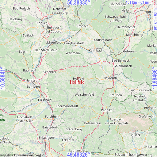
Hollfeld GPS coordinates[2]
49° 56' 16.548" North, 11° 17' 29.508" East
| Map corner | latitude | longitude |
|---|---|---|
| Upper-left | 50.38835°, | 10.58841° |
| Center: | 49.93793°, | 11.29153° |
| Lower-right: | 49.48326°, | 11.99466° |
| Map W x H: | 100.6×100.6 km | = 62.5×62.5mi |
| max Lat: | 55.01917° ⇑65.3% North |
| Hollfeld: | 49.93793° |
| min Lat: | ⇓34.7% South 47.40724° |
| min Long | Hollfeld | max Long |
| 5.92978° | 11.29153° | 14.98853° |
| W 71.2%⇐ | ⇒28.8% E |
Elevation
Elevation of Hollfeld is 405 m = 1329 ft, and this is 155.9 m = 511 ft above average elevation for this country.
| Max E: |
1256 m = 4121 ft | 24.1% |
| Hollfeld | 405 m 1329 ft | |
| Avg. | 249.1 m = 817 ft | |
Min E: |
-5 m = -16 ft | 75.9% |
See also: Germany elevation on elevation.city.
Geographical zone
Hollfeld is located in North temperate zone (between Tropic of Cancer and the Arctic Circle). Distance of this North polar circle is 1848.6 km =1148.7 mi to North.| Distance of | km | miles | from Hollfeld |
|---|---|---|---|
| North Pole | 4454.5 | 2767.9 | to North |
| Arctic Circle | 1848.6 | 1148.7 | to North |
| Tropic Cancer | 2946.7 | 1831 | to South |
| Equator | 5552.6 | 3450.2 | to South |


Nearby cities:
15 places around Hollfeld: (largest is in red/bold)
• Aufseß
7.6 km =4.7 mi,  217°
217°
• Eckersdorf
12.6 km =7.8 mi,  36°
36°
• Eckersdorf
14.7 km =9.1 mi,  91°
91°
• Glashütten
12.6 km =7.8 mi,  116°
116°
• Heiligenstadt
12 km =7.5 mi,  225°
225°
• Kasendorf
11.8 km =7.3 mi,  21°
21°
• Königsfeld
9.1 km =5.7 mi,  275°
275°
• Mistelgau
12.8 km =8 mi,  102°
102°
• Plankenfels
6.8 km =4.2 mi,  153°
153°
• Poxdorf
12.1 km =7.5 mi,  269°
269°
• Stadelhofen
9.9 km =6.2 mi,  317°
317°
• Thurnau
12.2 km =7.6 mi, 36°
• Unterleinleiter
14.7 km =9.1 mi,  209°
209°
• Waischenfeld
10.9 km =6.8 mi,  158°
158°
• Wonsees
4.3 km =2.7 mi,  8°
8°
Sources, notices
• [Note1] Compared only with cities in Germany existing in our database
• [Src1] Map data: © OpenStreetMap contributors (CC-BY-SA)
• [Src2] Other city data from geonames.org with taken over terms of usage.
• [Src3] Geographical zone / Annual Mean Temperature by Robert A. Rohde @ Wikipedia
