Sommerach geodata
Sommerach (Bavaria) is a seat of a fourth-order administrative division; located in Germany in Europe/Berlin (GMT+2) time zone. With population of 1,432 people, there are 6016 cities with bigger population in this country. Compared to other cities in Germany, 68.3% of cities are located further ↑North; 53.5% of cities are located further ←West and 53.7% of cities have higher elevation than Sommerach. Note1
Administrative division(s):
- Level 1: Bavaria
- Level 2: Regierungsbezirk Unterfranken
- Level 3: Landkreis Kitzingen
- Level 4: Sommerach


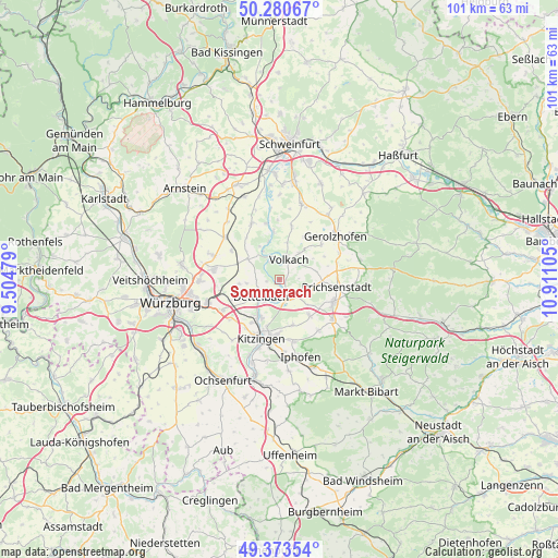
Sommerach GPS coordinates[2]
49° 49' 45.228" North, 10° 12' 28.512" East
| Map corner | latitude | longitude |
|---|---|---|
| Upper-left | 50.28067°, | 9.50479° |
| Center: | 49.82923°, | 10.20792° |
| Lower-right: | 49.37354°, | 10.91105° |
| Map W x H: | 100.9×100.9 km | = 62.7×62.7mi |
| max Lat: | 55.01917° ⇑68.3% North |
| Sommerach: | 49.82923° |
| min Lat: | ⇓31.7% South 47.40724° |
| min Long | Sommerach | max Long |
| 5.92978° | 10.20792° | 14.98853° |
| W 53.5%⇐ | ⇒46.5% E |
Elevation
Elevation of Sommerach is 199 m = 653 ft, and this is 50.1 m = 164 ft below average elevation for this country.
| Max E: |
1256 m = 4121 ft | 53.7% |
| Avg. | 249.1 m = 817 ft | |
| Sommerach | 199 m = 653 ft | |
Min E: |
-5 m = -16 ft | 46.3% |
See also: Germany elevation on elevation.city.
Geographical zone
Sommerach is located in North temperate zone (between Tropic of Cancer and the Arctic Circle). Distance of this North polar circle is 1860.7 km =1156.2 mi to North.| Distance of | km | miles | from Sommerach |
|---|---|---|---|
| North Pole | 4466.6 | 2775.4 | to North |
| Arctic Circle | 1860.7 | 1156.2 | to North |
| Tropic Cancer | 2934.6 | 1823.5 | to South |
| Equator | 5540.5 | 3442.7 | to South |


Nearby cities:
15 places around Sommerach: (largest is in red/bold)
• Albertshofen
7.6 km =4.7 mi,  203°
203°
• Buchbrunn
9.3 km =5.8 mi,  213°
213°
• Dettelbach
4.2 km =2.6 mi,  226°
226°
• Frankenwinheim
10 km =6.2 mi,  49°
49°
• Großlangheim
8.5 km =5.3 mi,  163°
163°
• Kleinlangheim
8.5 km =5.3 mi,  139°
139°
• Kolitzheim
9.9 km =6.2 mi,  10°
10°
• Lülsfeld
9.2 km =5.7 mi,  61°
61°
• Mainstockheim
7.7 km =4.8 mi, 213°
• Nordheim
3.7 km =2.3 mi,  333°
333°
• Oberpleichfeld
10.2 km =6.3 mi,  301°
301°
• Prichsenstadt
10.1 km =6.3 mi,  96°
96°
• Prosselsheim
6.9 km =4.3 mi, 302°
• Volkach
4.1 km =2.5 mi,  20°
20°
• Wipfeld
10.2 km =6.3 mi,  343°
343°
Sources, notices
• [Note1] Compared only with cities in Germany existing in our database
• [Src1] Map data: © OpenStreetMap contributors (CC-BY-SA)
• [Src2] Other city data from geonames.org with taken over terms of usage.
• [Src3] Geographical zone / Annual Mean Temperature by Robert A. Rohde @ Wikipedia
