Schwarzenbach geodata
Schwarzenbach (Bavaria) is a populated place; located in Germany in Europe/Berlin (GMT+2) time zone. With population of 1,129 people, there are 6764 cities with bigger population in this country. Compared to other cities in Germany, 68% of cities are located further ↑North; 86.7% of cities are located further ←West and 93.7% of cities have lower elevation than Schwarzenbach. Note1
Administrative division(s):
- Level 1: Bavaria
- Level 2: Upper Palatinate
- Level 3: Landkreis Tirschenreuth
- Level 4: Bärnau


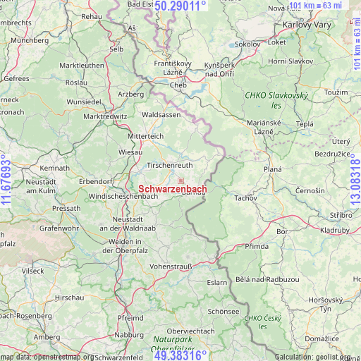
Schwarzenbach GPS coordinates[2]
49° 50' 19.536" North, 12° 22' 48.18" East
| Map corner | latitude | longitude |
|---|---|---|
| Upper-left | 50.29011°, | 11.67693° |
| Center: | 49.83876°, | 12.38005° |
| Lower-right: | 49.38316°, | 13.08318° |
| Map W x H: | 100.8×100.8 km | = 62.6×62.6mi |
| max Lat: | 55.01917° ⇑68% North |
| Schwarzenbach: | 49.83876° |
| min Lat: | ⇓32% South 47.40724° |
| min Long | Schwarzenbach | max Long |
| 5.92978° | 12.38005° | 14.98853° |
| W 86.7%⇐ | ⇒13.3% E |
Elevation
Elevation of Schwarzenbach is 569 m = 1867 ft, and this is 319.9 m = 1050 ft above average elevation for this country.
| Max E: |
1256 m = 4121 ft | 6.3% |
| Schwarzenbach | 569 m 1867 ft | |
| Avg. | 249.1 m = 817 ft | |
Min E: |
-5 m = -16 ft | 93.7% |
See also: Germany elevation on elevation.city.
Geographical zone
Schwarzenbach is located in North temperate zone (between Tropic of Cancer and the Arctic Circle). Distance of this North polar circle is 1859.6 km =1155.5 mi to North.| Distance of | km | miles | from Schwarzenbach |
|---|---|---|---|
| North Pole | 4465.5 | 2774.7 | to North |
| Arctic Circle | 1859.6 | 1155.5 | to North |
| Tropic Cancer | 2935.6 | 1824.1 | to South |
| Equator | 5541.6 | 3443.4 | to South |


Nearby cities:
15 places around Schwarzenbach: (largest is in red/bold)
• Bärnau
4.9 km =3 mi,  129°
129°
• Falkenberg
11.2 km =7 mi,  281°
281°
• Flossenbürg
11.9 km =7.4 mi,  190°
190°
• Floß
14.8 km =9.2 mi,  210°
210°
• Georgenberg
15.4 km =9.6 mi,  169°
169°
• Konradsreuth
12.3 km =7.6 mi, 209°
• Leonberg
13.8 km =8.6 mi,  330°
330°
• Mitterteich
16 km =9.9 mi,  321°
321°
• Mähring
13.1 km =8.1 mi,  52°
52°
• Neualbenreuth
16.4 km =10.2 mi,  16°
16°
• Püchersreuth
14.4 km =8.9 mi,  226°
226°
• Störnstein
17.2 km =10.7 mi, 226°
• Tirschenreuth
6 km =3.7 mi, 324°
• Wiesau
15.7 km =9.8 mi,  299°
299°
• Windischeschenbach
16.5 km =10.3 mi,  255°
255°
Sources, notices
• [Note1] Compared only with cities in Germany existing in our database
• [Src1] Map data: © OpenStreetMap contributors (CC-BY-SA)
• [Src2] Other city data from geonames.org with taken over terms of usage.
• [Src3] Geographical zone / Annual Mean Temperature by Robert A. Rohde @ Wikipedia
