Tirschenreuth geodata
Tirschenreuth (Bavaria) is a seat of a third-order administrative division; located in Germany in Europe/Berlin (GMT+2) time zone. With population of 9,410 people, there are 1719 cities with bigger population in this country. Compared to other cities in Germany, 67% of cities are located further ↑North; 86.1% of cities are located further ←West and 89.6% of cities have lower elevation than Tirschenreuth. Note1
Administrative division(s):
- Level 1: Bavaria
- Level 2: Upper Palatinate
- Level 3: Landkreis Tirschenreuth
- Level 4: Tirschenreuth


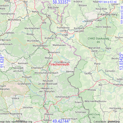
Tirschenreuth GPS coordinates[2]
49° 52' 57.468" North, 12° 19' 52.032" East
| Map corner | latitude | longitude |
|---|---|---|
| Upper-left | 50.33357°, | 11.628° |
| Center: | 49.88263°, | 12.33112° |
| Lower-right: | 49.42744°, | 13.03425° |
| Map W x H: | 100.8×100.8 km | = 62.6×62.6mi |
| max Lat: | 55.01917° ⇑67% North |
| Tirschenreuth: | 49.88263° |
| min Lat: | ⇓33% South 47.40724° |
| min Long | Tirschenreuth | max Long |
| 5.92978° | 12.33112° | 14.98853° |
| W 86.1%⇐ | ⇒13.9% E |
Elevation
Elevation of Tirschenreuth is 509 m = 1670 ft, and this is 259.9 m = 853 ft above average elevation for this country.
| Max E: |
1256 m = 4121 ft | 10.4% |
| Tirschenreuth | 509 m 1670 ft | |
| Avg. | 249.1 m = 817 ft | |
Min E: |
-5 m = -16 ft | 89.6% |
See also: Germany elevation on elevation.city.
Geographical zone
Tirschenreuth is located in North temperate zone (between Tropic of Cancer and the Arctic Circle). Distance of this North polar circle is 1854.7 km =1152.5 mi to North.| Distance of | km | miles | from Tirschenreuth |
|---|---|---|---|
| North Pole | 4460.6 | 2771.7 | to North |
| Arctic Circle | 1854.7 | 1152.5 | to North |
| Tropic Cancer | 2940.5 | 1827.1 | to South |
| Equator | 5546.4 | 3446.4 | to South |


Nearby cities:
15 places around Tirschenreuth: (largest is in red/bold)
• Berg
15.6 km =9.7 mi,  240°
240°
• Bärnau
10.8 km =6.7 mi,  137°
137°
• Falkenberg
7.9 km =4.9 mi,  250°
250°
• Fuchsmühl
14 km =8.7 mi,  288°
288°
• Konradsreuth
15.9 km =9.9 mi,  189°
189°
• Leonberg
7.9 km =4.9 mi,  335°
335°
• Mitterteich
10 km =6.2 mi,  320°
320°
• Mähring
14.2 km =8.8 mi,  77°
77°
• Neualbenreuth
13.5 km =8.4 mi,  36°
36°
• Pechbrunn
15 km =9.3 mi,  308°
308°
• Püchersreuth
16.3 km =10.1 mi,  205°
205°
• Schwarzenbach
6 km =3.7 mi, 144°
• Waldsassen
13.4 km =8.3 mi,  351°
351°
• Wiesau
10.6 km =6.6 mi, 285°
• Windischeschenbach
15.4 km =9.6 mi,  233°
233°
Sources, notices
• [Note1] Compared only with cities in Germany existing in our database
• [Src1] Map data: © OpenStreetMap contributors (CC-BY-SA)
• [Src2] Other city data from geonames.org with taken over terms of usage.
• [Src3] Geographical zone / Annual Mean Temperature by Robert A. Rohde @ Wikipedia
